2010-11-28 46 7
| Sun 28 Nov 2010 in 46,7: 46.8809510, 7.4843471 geohashing.info google osm bing/os kml crox |
The Place
The hashpoint is at a farm house near the village of Zimmerwald, which is itself 10 km South of Berne.
Who Went
TheOneRing - by bike.
The Expedition
TheOneRing
At the village of Zimmerwald there is located the Zimmerwald observatory which is part of my work centre. So I know the area very well. I decided to go by bus to Zimmerwald and then walk the last 2 km to the hashpoint. The view was very nice, but the roads were quite slippery due to the snowfall in the last days.
The hashpoint itself was located at a farm house and was easy to reach. The dog there was very alert what I was doing there. It did nothing but barking several times. I suspected that the temperature was low enough to get the Frozen Geohash achievement I brought a thermometer and I was right to do so.
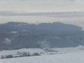
After taking the other usual photographs I chose a different way back and walked to the village of Belp, which rewarded me with another wonderful view of the countryside and extended to the Alps (see below). Then I took the train back to Berne.
Photos
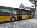
The bus I took to Zimmerwald
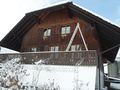
The farm house at the hash point

Non-stupid grin
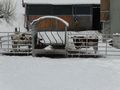
Cows (probably deep frozen)
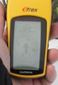
The proof that I reached the coordinates
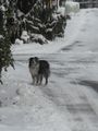
The dog of the farm house (was not happy about my presence)
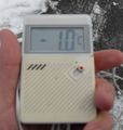
The proof of the actual temperature
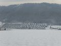
Wonderful view over the countryside
Same as before
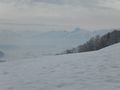
Again, but with the Alps in the background
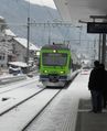
The train back to Berne


