2011-08-27 -38 145
| Sat 27 Aug 2011 in -38,145: -38.1807526, 145.0797592 geohashing.info google osm bing/os kml crox |
Contents
Location
In a creek at Mt Eliza.
Who went
Expedition
Felix Dance
This turned out to be much more of an adventure than I'd expected.
At work as usual on a Saturday I discovered that the hash was on a detour for my route home. Also not sitting in private property I knew I had to go for it. Finishing up early at about midday and sneaking out I jumped in the car on this beautiful sunny Saturday afternoon and sped off towards Port Philip Bay, being careful to skirt around the intervening Western Port Bay.
Sadly, climbing the steep Mt Eliza I realised my car's clutch had almost totally given out - quite annoying since only three weeks ago I'd had it replaced. This sadly, gave the trip the sheen of frustration that was difficult to shed.
Arriving within 30m of the hash at 1:30pm I quickly dis-car-ed and headed for the location without much ado other than test-riding a bike advertised for free on the nature strip nearby.
But immediately I hit a brick wall - literally an extended thick clump of spikey blackberry bushes that I discovered to be impenetrable and impassable without a machete. Was this hash to end in failure?
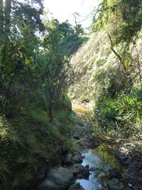
No. I walked up-stream beside the surprisingly deep valley of Earimil Creek until I found a landslide that allowed me access to the water below with my clothes/skin intact. The next TWO HOURS saw me g...r...a...d...u...a...l...l...y clambering down this small flowing creek 250m towards the hash. That's right. Barely over 100m an hour. In the process I was torn to bits, blood oozing from many new orifices in my epidermis, spider-scurried upon, drenched with sweat and water and covered in vegetable detritus. It was really starting to get me down.
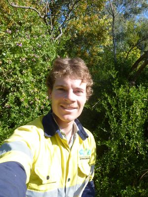
The last straw came as I was trying to step over a slippery rock onto a log above the water. The log sank under my weight soaking my street shoes. It was at that point that I checked the GPS: only 10m to go. With great jubilation I clambered up the less-blackberry-bushy south slope to the exact location, took some photos and then stood around wondering how I was going to get out.
At this point I almost felt claustrophobic - I couldn't bring myself to back track the last two hours, nor could I just climb up out of the valley to my car. I decided to keep tracking the creek to the beach and this worked for a while, but in the end I just climbed up the south slope and collapsed with exhaustion onto the back lawn of a posh property where the family was enjoying their Sunday lunch.
"Err...," I asked, hesitatingly, "Can I get through your house to the street?".
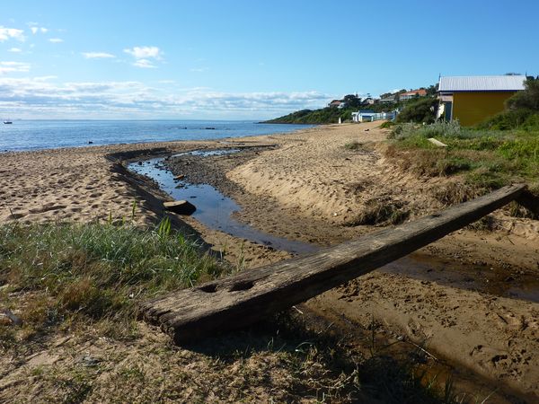
They acquiesced and I was free. Unfortunately, I was on the wrong side of the valley from my car. So I walked through the fancy Mt Eliza suburban streets to the ocean - Port Philip Bay to be precise - where I beheld some incredible views over the sun-speckled water to the city and the You Yang mountains on the other side. Nowhere else along the Bay, and I've circumnavigated it many times by various modes of transport, had I had such a comprehensive view of the Seven Hills of Melbourne surrounding the Bay. The city buildings budded up from the horizon like shoots of grass, or like some 1980s vision of the future. The warm breeze beckoned me into the water, but I was running out of time to perform various social duties at home. I descended the stairs to a small beach and the mouth of Earimil Creek where I beheld the sight of exclusive properties overlooking the bay and their colourful beach boxes below, old couples and young families taking in the seaside scenery with a few beers and a bucket and spade. Within minutes I was back up the other side and at my car, driving home to my folks' place in North Melbourne, the taste of blood on my fingers and a sodden shoe the only physical tokens of the geohash.
Here is the Google Maps route I took.


