2011-09-25 57 -2
| Sun 25 Sep 2011 in Aberdeen: 57.5772031, -2.9483148 geohashing.info google osm bing/os kml crox |
Contents
About
After taking smoulder to Aberdeen airport, Damianc made this expedition on the way back home.
Expedition
Today's hash all looked pretty straightforward, if a little dull, being in the middle of an unremarkable field, so I figured I'd check it out on the way back home.
Today's hash was pretty straightforward, if a little dull, being in the middle of an unremarkable field.
Hashscots seem to be more popular these days, so I thought I'd join the crowd, and took 2470wnx (my monitor lizard) with me.
You are in a maze of twisty little passages, all alike
Google maps shows that there is a network of small roads criss-crossing the area around the hashpoint. So, although it seems the google streetview cameras had not made it down many of these roads, it looked from the OS map that many should be passable, so I decided to take the scenic route home.
You are at the hashpoint. A narow road lead right, the way you came, and left, past a farmhouse.
left
you are at a crossroads
right
uou are at a crossroads
left
You are at a fork in the road. Left leads back to the country, right leads downwards.
right
You are at a ford across a burn
cross burn
The road has deteriorated to a rough track
forwards
The road has deteriorated further
forwards
You are in someone's garden
At this point I retreat and take a simpler route home.
Photographs
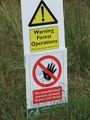
Obey ALL signs!!
