File:20120209 53 -1 ScreenshotB.png
From Geohashing
Revision as of 09:51, 9 February 2012 by imported>Monty (Follow-up 'proof' of the scratch-built GPS application. As close to the point as could be reasonably be gotten, from the entrance off of "Decoy Bank South". Category:Meetup in 53 -1 Category:Meetup on 2012-02-09 Category:GPS receivers)
Size of this preview: 537 × 599 pixels. Other resolutions: 215 × 240 pixels | 665 × 742 pixels.
Original file (665 × 742 pixels, file size: 64 KB, MIME type: image/png)
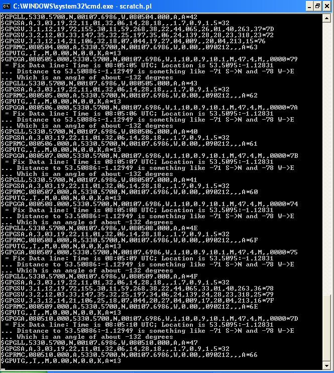
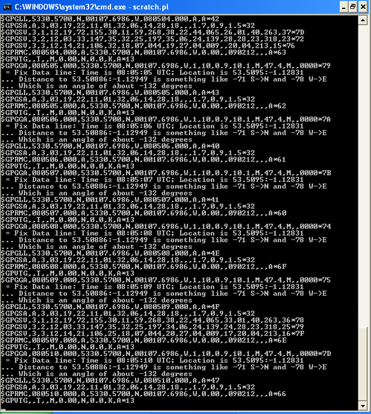
Follow-up 'proof' of the scratch-built GPS application. As close to the point as could be reasonably be gotten, from the entrance off of "Decoy Bank South".
File history
Click on a date/time to view the file as it appeared at that time.
| Date/Time | Thumbnail | Dimensions | User | Comment | |
|---|---|---|---|---|---|
| current | 17:25, 30 January 2020 | | 665 × 742 (64 KB) | Maintenance script (talk | contribs) |
- You cannot overwrite this file.
File usage
The following page links to this file: