Location
In a small forest near Sachsenbrunn, Thuringia, Germany.
Participants
Expedition: Reinhard
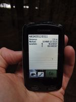
Manu and Reinhard stayed at Manu's parents that weekend, from where it would have been 23 km one way to the hashpoint by bike. Reinhard thought about cycling there between breakfast and lunch, but there were many roads and bike paths to GPS-track for the quaeldich.de trip planner near the hashpoint, which would have made the trip much longer. Reinhard preferred to concentrate on those new tracks instead of taking the boring ways he already knew and drove to Hirschendorf, where he started the bike trip. A nice paved path was passing the hashpoint by about 150 m. A muddy forest path got him as close as 15 m and the rest could easily be walked between the trees. GPS reception was bad, so Reinhard couldn't get the GPS device to show less than 2.9 m distance. Coordinates reached anyway ...
Photos: Reinhard
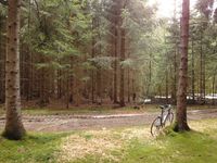
| It's 15 m into the trees behind the bike
|
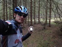
| Reinhard at the hashpoint and the bike in the background.
|
|


