2012-06-19 -43 172
From Geohashing
Revision as of 04:38, 13 August 2019 by imported>FippeBot (Location)
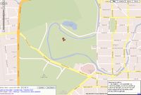
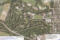
| Tue 19 Jun 2012 in -43,172: -43.5300098, 172.6209986 geohashing.info google osm bing/os kml crox |
Location
Participants
Plans
The Hashpoint was in the local Botanical Gardens, so I went there during my lunch hour.
Expedition
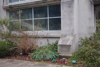
Easy enough; that is, after going home from work to pick up my camera and make a hash marker, only to realise I had forgotten my house key, so back to work, then back home, then to the Gardens. I relied more on my printout from carabiner.peeron, but had my GPS as well (which didn't want to be accurate enough to give me the exact "seconds to 2DP" value, and is a bit hard to see in the photos...). I made the hash marker out of an ice-cream container lid, with a spike to stick in the ground. I need to learn how write more precisely...
Photos
|
Achievements
ShadowHash earned the Land geohash achievement
|
Er, no photo proof (no tripod for self-portrait...)


