2012-10-12 66 26
From Geohashing
Revision as of 17:47, 12 October 2012 by imported>Isopekka (Created page with "thumb|left {{meetup graticule | lat=66 | lon=26 | date=2012-10-12 }} == Location == In the forest in Vikajärvi, but quite easy to rea...")
| Fri 12 Oct 2012 in 66,26: 66.5891217, 26.3261905 geohashing.info google osm bing/os kml crox |
Contents
Location
In the forest in Vikajärvi, but quite easy to reach. About 35 km from my home.
Participants
Expedition
- By car total 70 km
- Walking total 0.6 km
- Expedition took 1.5 h
- Physical effort (1-5): 2
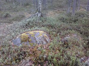
My expedition started at 9:00 a.m. I could drive very close to the Hash, had to walk only 300 meters into the forest. This time it was easy to walk, not so dense forest. Beautiful morning, nobody seen, no animals seen. Only me an nature. Fine!
Photos
Achievements
isopekka earned the Land geohash achievement
|
Geohashing Expeditions and Plans on This Day
Expeditions and Plans
| 2012-10-12 | ||
|---|---|---|
| Madison, Wisconsin | SwensonJ | Farmland northwest of Lake Mendota, near Governor Nelson State Park |
| Norrköping, Sweden | Deion | On a field in the Swedish countryside. |
| Vanttauskoski, Finland | isopekka | In the forest in Vikajärvi, but quite easy to reach. About 35 km from my ho... |


