2012-11-30 30 -81
| Have you seen our geohashing marker? We'd love to hear from you! Click here to say "hi" and tell us what you've seen!
Curious about what geohashing is? Read more! |
| Fri 30 Nov 2012 in Jacksonville, Florida: 30.5661283, -81.6142533 geohashing.info google osm bing/os kml crox |
Expedition
The Plan
Off Main Street north of Pecan Park. Take I-95 instead because it's likely to be quicker, then dart in for a quick achievement.
The Geohashers
The Adventure
I already had the day off, which is good because this wouldn't have been quite so easy if it were dark out. We hopped in the car around 1:30 and drove on up. Upon arrival was the worst thing about Florida's autumn and winter - there's still bugs and specifically bees flying around. Don't think we got bit, but I'll give it until tomorrow to decide.
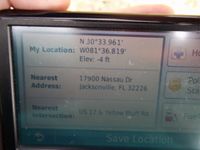
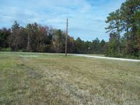
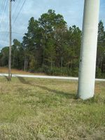
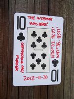
The main problem was that as we approached the power line, our GPS decided to stop giving us accurate readings. Damn it all. We took the picture anyway, then I took a few more establishing shots while Erica took off, being allergic to bees and all. I stomped around for a while to be sure I was on the geohash before hightailing it for the car myself. As a screw you to the power lines, we stapled the Ten of Clubs to it. Take that!
Gallery
- Photo Gallery


