2013-04-16 63 28
| Tue 16 Apr 2013 in 63,28: 63.7227043, 28.6105782 geohashing.info google osm bing/os kml crox |
Location
In Karjokangas, Koppelo, Valtimo. The point lies in the edge of a swamp.
Participants
- Pastori
- The Wife
Plans
A cloudy and moist morning in Valtimo. Few degrees centigrade. Roads suffering from rasputitsa. Not too eager to go outside at all. But:
Hashpoint is once again very close, only 3,3 km as the bird flies. It seems also that it is possible to get quite near with a car. So we need to go.
Expedition
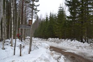
Packing along snow shoes and photographing equipment = The Wife and camera. First we drive about 5,5 km by car and leave it beside the road Murtomäentie. We start walking along Karjosuontie, which, to our delight, seems to be ploughed with a tractor. After 100 meters, our joy ends as there is a cottage, after which the road is not ploughed. Someone has been driving on the road with snowmobile and leaving a hard-packed trail. Thus our feet sink only 10 cm even without the snow shoes.
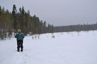
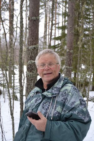
We walked 1,25 km along the road, and then had to turn into the swamp and untouched snow. Snow shoes on. After some circling we found the point successfully. It lies almost at the edge of the swamp, a little bit on the forest side. Closest reading 5,74 meters. Pretty good!
Going back with our own tracks was easier, but the morning hike was very nice and suitably exhausting, too. The Wife was excited, that we once again got ourselves moving. Pastori agrees.
Pastori came to think of the motives of the person who has invented this geohashing-thing. Maybe he had a hidden agenda to get the mankind to exercise a little bit more, that's actually quite cunning. Thanks for him!
On the return journey we saw on the roadside first time this spring 3 Northern Lapwings and 2 Common Starlings, which are usually among the first migrating birds in our area.
Additional photos
Achievements
Pastori earned the Land geohash achievement
|


