2015-05-17 66 25
From Geohashing
Revision as of 17:47, 17 May 2015 by imported>Isopekka (Created page with "thumb|left {{meetup graticule | lat=66 | lon=25 | date=2015-05-17 }} == Location == In Rovaniemi, in forest == Participants ==...")
| Sun 17 May 2015 in 66,25: 66.4769379, 25.8741651 geohashing.info google osm bing/os kml crox |
Contents
Location
In Rovaniemi, in forest
Participants
Expedition
- Driving total 12 km
- Walking total 3 km
- Expedition took 2 h
- Physical effort (1-5): 2
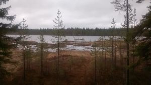
Expedition started about at 11 a.m. The hashpoint situated in the forest north of the lake Toramo. I had to walk first around a shooting area and then directly to the hash. Luckily it was very easy to walk in forest because the forest was not too dense.
Photos
Achievements
isopekka earned the Land geohash achievement
|
Geohashing Expeditions and Plans on This Day
Expeditions and Plans
| 2015-05-17 | ||
|---|---|---|
| Le Vauclin, Martinique | Dunaril, Katu | On a residential hill of the Marin city over the splendid Baie du Marin, in... |
| Portland, Oregon | Jim | Near Farmington Road in Beaverton |
| Pforzheim, Germany | Klaus | on a field near Neustetten/Rottenburg |
| Schweinfurt, Germany | Reinhard | The hash is on a meadow close to the pass between Biberau and Oberwind. |
| Rovaniemi, Finland | isopekka | In Rovaniemi, in forest |


