2016-07-30 50 10
From Geohashing
Revision as of 08:35, 1 August 2016 by imported>Reinhard (report)
| Sat 30 Jul 2016 in 50,10: 50.5973940, 10.8780579 geohashing.info google osm bing/os kml crox |
Location
In the Thuringian Forest between Allzunah and Schönbrunn barrage, Germany.
Participants
Expedition
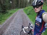
Shoul become a quick evening ride for Reinhard. Using a road bike on that horrific gravel path through the forest was a bit tricky. From the path it was a steep slope down on rocks and woodcut into a wet creek valley. Hashpoint was naturally 5 m behind the creek ...
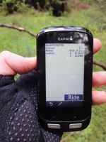
After successfully reaching the point, Reinhard decided to ride further down the valley to avoid the bad gravel part. Reached Schönbrunn barrage and paved roads there. Back after about 1:45 hours.
Tracklog of the bicycle ride
Photos
|

