2017-05-10 50 11
| Wed 10 May 2017 in 50,11: 50.8156049, 11.5644912 geohashing.info google osm bing/os kml crox |
Location
On a canola field near Kahla and the village of Zwabitz, Thuringia, Germany.
Participants
Expedition
Due to several family events and unfriendly weather my last (serious) bicycle ride was two and a half weeks ago which was far too long and forced me to go for this reasonably close geohash. Since both kids refused to accompany me in the bicycle trailer after I'd come home from work, I felt responsible to help Manu getting the little ones ready for bed which took us until about 9 pm and meant that it was almost dark when I started my ride alone.
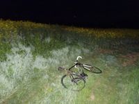
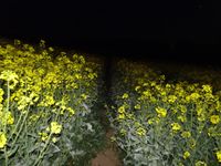
Taking the bike paths to Rothenstein and the new sections of the B88 I arrived at the small road between Kahla and Zwabitz shortly after 10 and continued on a field path which soon was surrounded by canola fields. Using this path I couldn't get closer than 120 m to the hashpoint and thought about giving up since the canola had almost grown to human size and I didn't want to trample down 150 m of canola plants. On the other hand I didn't want to give up too soon and quickly found tractor tracks leading in a good direction. I paused my GPS bike computer (which shall only count cycled distance) and dismounted it to follow the tractor track which finally got me as close as about 15 m. I decided the remaining distance was short enough to struggle through the plants and got within a 2 m circle without starting hashdances.
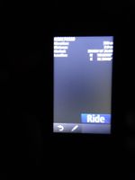
While I was trying to take a readable photo of the location proof on my GPS device I recognized some kind of grunting at a distance of maybe 10 m. Of course, due to the darkness (despite the full moon) and the high and dense canola I couldn't see anything. Immediately, I imagined a family of angry wild pigs and got quite nervous. As always, when in a hurry, my camera was totally overburdened with focussing and setting exposure, so I couldn't manage to take any sharp picture for proof before panicing since the grunting was still going on. I decided to continue the GPS recording, so I would still have a clear proof. Not knowing how to react in case of a wild pig meetup and probably being the loser in a man-vs-pig-family fight, I decided to quickly jump back to the tractor track and follow this running as fast as possible back to my bike which makes me feel safe and superior.
After gasping for breath I got on my bike and followed smaller, but more direct paths back to the road. Meanwhile, I noticed several sirens of emergency vehicles in the distance near Kahla and wondered whether the helicopter I'd seen before had noticed me in the canola field and sent a dozen police cars to chase me. Of course, this quickly turned out to be a figment of my imagination, caused by the wild pig issue. Back on the B88 towards Rothenstein, three big fire trucks with sirens overtook me and finally met with others, coming from all direction, in Rothenstein where they blocked my bike path to Maua. There was a smell of smoke in the air, but I couldn't see fire, but only large water puddles around the fire trucks. As the news of the following day clarified, there was indeed a fire in a school. For me it meant I had to follow the B88 which is under huge reconstruction in the whole area between Jena and Kahla. Turned out the new road is not any longer free for cyclists and the tarmac of the old road (which I finally took) had already been removed. Nevertheless, I got home sometime after 11 pm and was glad not to be eaten by wild animals.
Still, what scares me, is that this was my 2nd expedition (here is the 1st) within a short period of time where I had to pass a fire service.
Tracklog
Photos
|


