2021-03-15 51 13
| Mon 15 Mar 2021 in Dresden: 51.0409840, 13.8327779 geohashing.info google osm bing/os kml crox |
Location
Today's location is on a very steep hillslope overlooking the Elbe at Dresden-Wachwitz.
Country: Germany; state: Sachsen (Saxony, EU:DE:SN); district: Dresden; Stadtbezirk: Loschwitz; Stadtteil (city district): Loschwitz/Wachwitz
Weather: clouded, slight rain at the hashpoint
Expedition
Danatar
4 months! 4 months and 8 days since my last expedition. Looking up the coordinates each day, just to find out that the spot is too far away (the corona virus pandemic restricts how far from our home we are allowed to go), or in a restricted area (the sewage plant last week), or it's a day where I have to stay within 15 minutes distance of my workplace. You people probably thought I had given up on geohashing... But now I'm back, and this is how it went:
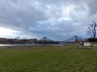
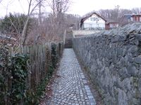
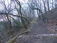
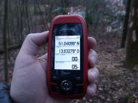
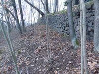
After celebrating privately in front of my computer that finally there would be a hashpoint in reach, I made plans to visit this spot on monday after work. These plans included forgetting Scott and my bike odometer at home when I left in the morning, but at least I packed the GPS unit. In the evening, I took my bike and cycled through Blasewitz (admiring the beautiful historic villas along the way, as usual) and across the Blaues Wunder bridge. Then I took the cycling track along the Elbe. As far as I remember, I had never used this part of the track on this side of the river before. At Wachwitz I took some small streets and even walking lanes with stairs up the hill, until the last paved lane finally ended at a dirt path. It was very steep and thus difficult. Then I walked further uphill along that path until I reached the top of the slope (elevation 100 m above the river, but <600 m away from it), about 40 meters from the hashpoint. Through the gaps in the trees I was able to look far along the Elbe. The slope dropped steeply off towards the spot at an angle of about 40° and there was a small house standing where I estimated the hashpoint to be. Would this be a "no trespassing" expedition? I can't traipse around in somebody's garden. Since there was no fence and I was still within the forest, I decided to test how far I would get. I carefully climbed down the slope, which wasn't easy due to the steepness and the loose soil. When I finally came near a fence that would block further descent, I noticed that the GPS already pointed to the side where nothing blocked the way. I walked another few meters and I was already below that small house, which I now noticed was an uninhabited and decrepit hut. It started to rain very slightly. The GPS dance was a bit difficult because of the steep slope and a small wall supporting the slope beneath the hut, but I finally was at the spot.
After celebrating for a moment, I climbed up the hill again, walked along the path to my bike, and rolled down the hill to the Elbe (I noticed I should readjust the brakes). Then I cycled through the light rain along the Elbe back to the Blaues Wunder bridge and through the residential areas back home.
In total, I cycled about 12 km.
|
tracklog
will follow
