2022-07-23 51 13
| Sat 23 Jul 2022 in Dresden: 51.0676200, 13.8226480 geohashing.info google osm bing/os kml crox |
Location
Today's location is in the Dresdner Heide forest.
Country: Germany; state: Sachsen (Saxony, EU:DE:SN); district: Dresden; Stadtbezirk: Loschwitz; Stadtteil (city district): Dresdner Heide
Expedition
Danatar
(this report is 11 months late, I don't remember too many details)
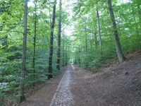
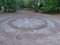
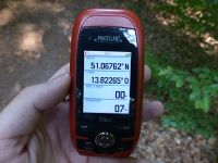
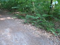
This hashpoint was not far, so it was easy to reach. I just had to get to the Weißer Hirsch district first, which I did by bus. At the time of the expedition (for three months), there existed a federally sponsored public transport ticket for busses and basic trains in the whole of Germany that only cost 9 € per months and I wanted to use it as much as possible. The alternative would have been to cycle up the rather high hill, no thank you. From the bus station I walked along a forest track, past a tiny source, then along another forest track. Soon I was a a crossroads in the forest. Somebody had made a large marker out of white stones and concentric dirt there, but it was not at the hashpoint. It looked more like a ritual circle to summon Randall, but I refrained from doing so. Not only because it would be rude to interrupt whatever he was doing at the time, but also because I had no goats or virgins with me. A few meters further, I did my GPS dance to find the exact spot. I took some pictures and went home.
|
tracklog
(Woohoo, finally the tracklogs uploaded directly to the wiki work! I think the problem was my old computer...)
