2023-07-26 52 8
| Wed 26 Jul 2023 in 52,8: 52.6515817, 8.2795010 geohashing.info google osm bing/os kml crox |
Location
This Geohash is located next to a path in a bog in Lohne.
Participants
Expedition
After work, I took the train to Lohne. During yesterday's expedition to Fladder I had left my bike at the station here.
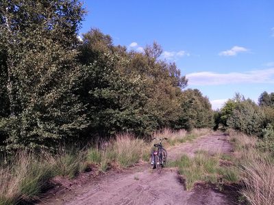
I unlocked my bike and cycled eastwards to the Geohash. The coordinates were in a bog, but right next to a path, so there shouldn't be any accessability problems, right?
The problem was to get onto that path in the first place. There was a house on Sommerweg where the path should have started, and they had the first meters fenced in with the rest of their property. So I had to go between the fence and the edge of a field, but that worked fine, once the house was behind me, I could continue to cycle on the path.
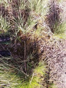
The coordinates were indeed right next to the path. There also were a bunch of dragonflies there. After recording proof, I continued onwards.
I wanted to avoid the aforementioned house, so I was looking for a different way out of the bog. There was supposed to be a path, but without the map, I'd have completely missed it. The first few hundred meters were not very well maintained, but eventually the path developed into something that I could cycle on, and soon afterwards I was back on a main road.
The plan was to cycle back home completely to mirror yesterday's expedition. However, after stopping to rest and eat in Steinfeld and still being tired, I figured that there was no way I was going to cycle for more than another two hours, not to mention the Damme and the Wiehen hill ranges.
Instead, I took the train back to Osnabrück from Steinfeld.
Photos
Tracklog
Ribbons
Fippe earned the Land geohash achievement
|


