2023-10-29 64 25
| Sun 29 Oct 2023 in 64,25: 64.9171734, 25.5969208 geohashing.info google osm bing/os kml crox |
Location
In the Haukkasuo bog in Kempele.
The point on a topographic map: [1]
Participants
Expedition
According to the GPS receiver, the distance of the trip was 24.2 km, of which I cycled 23.1 km and walked 1.1 km in total.
Tracklog
I removed a part of the tracklog around photo 12 so I would not reveal the final locations of a couple of multicaches.
Photos
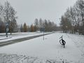
The urban road near Kaakkuri.
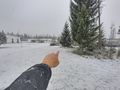
Pointing at the 2023-03-05 retrohash.
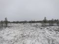
View from the top of the hill.
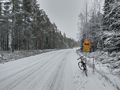
The gravel road that I followed towards the hashpoint.
The bicycle parked by the roadside, about 300 metres to go.
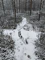
A frozen ditch with strong enough ice to walk on.
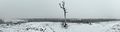
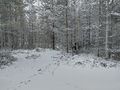
The hashpoint was here, pretty much in the middle of the photo, in a frozen semi-open swamp.
Stupid Grim™
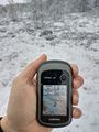
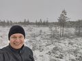
Proof of location.
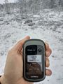
Proof of date and time.
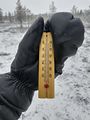
Proof of temperature.
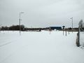
There should be a road and a cycleway here, somewhere.


Achievements
Kripakko earned the Land geohash achievement
|
Kripakko earned the Bicycle geohash achievement
|
Kripakko earned the Frozen Geohash Achievement
|