File:2024-05-31 32 -96MapView.jpg
From Geohashing

Size of this preview: 277 × 599 pixels. Other resolutions: 111 × 240 pixels | 1,170 × 2,532 pixels.
Original file (1,170 × 2,532 pixels, file size: 1.02 MB, MIME type: image/jpeg)
Summary
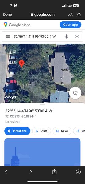
A satellite view of the exact location of the hashpoint.
File history
Click on a date/time to view the file as it appeared at that time.
| Date/Time | Thumbnail | Dimensions | User | Comment | |
|---|---|---|---|---|---|
| current | 02:27, 1 June 2024 | | 1,170 × 2,532 (1.02 MB) | Haberdasher (talk | contribs) | A satellite view of the exact location of the hashpoint. |
- You cannot overwrite this file.
File usage
The following page links to this file: