2024-07-13 50 8
From Geohashing
| Sat 13 Jul 2024 in 50,8: 50.2166294, 8.5512527 geohashing.info google osm bing/os kml crox |
Location
On a footway in the northwest residential area of Oberursel (Taunus), Hochtaunus county, Hesse, Germany. The Camp-King-Park lies to the east.
This day’s weather: partially/completely clouded, windy?, 18–23 °C
Participants
- Green guy! (talk)
- Green guy!’s mother (no consent to publish photos of her)
- Green guy!’s father (no consent to publish photos of him)
Plans
- Drive to Oberursel in the forenoon
- Park our car near the hashpoint
- Walk to the coordinates
- Have an enjoyable walk in the Camp-King-Park
- Have lunch at a nearby restaurant
- Drive back home
Expedition
The way there / ___ visit
As planned, my parents and I drove to __RESTAURANT__ in __STADT__ via B123. We had a delightful time there; I ate a delicious __MEAL__.
Reaching the coordinates
After lunch, we visited the hashpoint: We parked our car ____ and ____
The way back home
Final verdict
Tracklog: Walking to the hashpoint / Visiting _____
Pictures
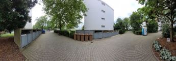
Panorama @50.2167,8.5512

Achievements
Recurring
I already earned these from an earlier geohash, but fulfilled the conditions again on this one.