2009-04-18 40 -87
| Sat 18 Apr 2009 in Danville, Illinois: 40.0845888, -87.8377370 geohashing.info google osm bing/os kml crox |
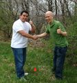
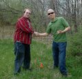
The day's coordinates fell in a field bordered by a wooded ravine and a convenient gravel lot. Brett, Alejandro, and Lucas made it to the precise location. They left a flag, played Go, and met the owners of two adjacent properties. On the way home, they encountered an amazing post-apocalyptic landscape hidden among the cornfields.
Expedition
Alejandro prompted this geohashing trip. With little effort, he was able to convince Brett to take a break from work to go on an adventure. Similarly, Lucas required little convincing, and the three set off from the UIUC campus around 3:20.
As usual, they avoided the interstate and passed through several small towns on their short trip east. In St. Joseph (population ≈3,000), they passed what Brett thinks is the ugliest building in central Illinois. He dislikes the flimsy and ill-proportioned fake facade that barely hides a run-down steel warehouse. Lucas and Alejandro, meanwhile, think it looks cool.
It took only 40 minutes to reach the geohashing point. It fell in a small field at the end of a long and winding gravel road. They parked in a lot that seemed made for the convenience of geohashers.
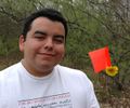
A short walk across the field took them to the precise point. They placed an orange marker flag and congratulated themselves on reaching the coordinates.
They were fortunate the coordinates fell so near the road. Had it fallen just a few feet to the west, they would have had to bushwhack into a densely-forested ravine. A few feet north would have put it behind a fence laden with "No Trespassing" signs.
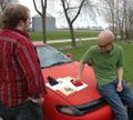
With the primary goal accomplished, Brett and Lucas played Go while Alejandro admired two horses in a paddock south of the coordinates. While taking pictures, Alejandro met the horses' owner. She brought the horses closer and explained that she had rescued them from a nearby farm that was mistreating its animals. She hopes to adopt 16 more!
Meanwhile, Brett and Lucas met the owner of the property north of the coordinates. Brett explained geohashing as "an internet game in which we visit random locations", and the owner explained some of the history of the area. He pointed across the ravine at an old mill that "should have become a state historical site."
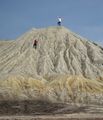
The three geohashers took a different route home. About four miles southwest of the coordinates, they passed an active quarry surrounded by bleak mounds of sand and stone. Lucas and Alejandro climbed one of the mounds and were rewarded with a sweeping panorama of the surrounding cornfields, a vivid green lake, and the rest of the quarry.
The entire complex looked post-apocalyptic. Nothing grew on the gray landscape, and endless ranges of mounds enclosed more lakes of bright green water. A lone drag line squatted on the bank of one of the lakes.
Similar quarries are scattered all across the country, but had it not been for geohashing, Alejandro, Brett, and Lucas would have never known one existed so close to UIUC. Between the quarry and the landscape around the geohashing point, this trip demonstrates that central Illinois contains more than just cornfields.


