2016-07-19 62 27
| Tue 19 Jul 2016 in 62,27: 62.3051341, 27.7136473 geohashing.info google osm bing/os kml crox |
Location
Near the lake Iso-Salminen, Joroinen municipality, Finland. The point lies in a forest.
Participants
- Tilley
- Mrs. Tilley
Expedition
From the first point we continued towards Varkaus, and shortly before reaching it we located the hash-road, and navigated to the closest point of road, about 250 meters from the point. Looking at the map, we had noted that the point was very near a small lake, and from the road there was a gentle downslope towards the point. It was almost certain there would be blueberries, so we had taken our berry-picking equipment with us as well.
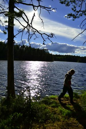
Because of the anticipated longer trek in the forest, we changed our shoes and trousers. However, when starting towards the point, we noticed there was a good path leading straight towards the lake and the point. How nice! We wandered towards the point, at the same time leisurely picking blueberries and trying to spot mushrooms. The point was indeed in a beautiful place, a few meters from the shore of the lake. The sun was shining from beyond the lake, and everything was very fresh, green and quiet. If you have to spot some downside from this kind of place, it was the shoreline. It was very soft, almost swampy, so it would be very difficult to get in and out of the lake. Also, there was only a meter of water before swampy bottom. So we didn't swim this time, although in places like this we usually do.
Nevertheless refreshed, we continued our journey.
Photos
Achievements
Tilley earned the Multihash Achievement
|
Tilley&co earned the Land geohash achievement
|


