Difference between revisions of "2008-05-24 -43 172"
From Geohashing
imported>Ekorren m (Undo revision 176562 by 207.35.172.214 (Talk)) |
imported>JimmyNZ m |
||
| Line 6: | Line 6: | ||
}} | }} | ||
| − | The [[Christchurch, New Zealand|Christchurch]] geohash for Saturday was located near the top of Mt Gray (900m) | + | ==Plan== |
| + | The [[Christchurch, New Zealand|Christchurch]] geohash for Saturday was located near the top of Mt Gray (900m) and it's hard to tell where the Popper Road ends, could be a 1km walk, possibly even worth a [[MNIMB Geohash|MNIMB Award]]. | ||
| + | |||
| + | |||
| + | ==Expedition== | ||
| + | It turned out to be more difficult with [[User:Phire|Phire]] having to be rescued by the police. Did not help that the track is no longer maintained by DOC. | ||
| + | |||
===People=== | ===People=== | ||
Revision as of 20:41, 30 April 2011
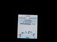
| Sat 24 May 2008 in -43,172: -43.1266480, 172.5475331 geohashing.info google osm bing/os kml crox |
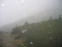
Plan
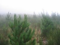
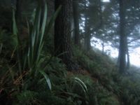
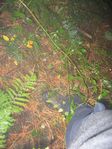
The Christchurch geohash for Saturday was located near the top of Mt Gray (900m) and it's hard to tell where the Popper Road ends, could be a 1km walk, possibly even worth a MNIMB Award.
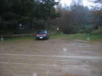
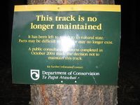
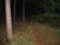
Expedition
It turned out to be more difficult with Phire having to be rescued by the police. Did not help that the track is no longer maintained by DOC.
People
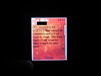
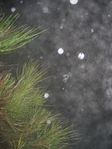
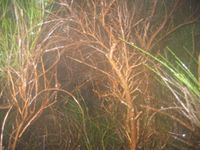
Phire attempted to reach it, but ended up having to be rescued by the police, full story to follow, but now you can get a series of photos with brief descriptions.
Zorg created a new Achievement in honor of Phire's Attempt, see MNB_Geohash.
- Pictures, click for more details.