Difference between revisions of "2008-05-24 40 -86"
From Geohashing
imported>Polysylabic Pseudonym (Categorising.) |
imported>Thomcat (Success/failure category added) |
||
| Line 26: | Line 26: | ||
Image:2008-05-24 40 -86 fauna.jpg|State highways, where Miller Lite goes to die. | Image:2008-05-24 40 -86 fauna.jpg|State highways, where Miller Lite goes to die. | ||
</gallery> | </gallery> | ||
| + | |||
| + | [[Category:Expeditions]] | ||
[[Category:Expeditions with photos]] | [[Category:Expeditions with photos]] | ||
| − | [[Category: | + | [[Category:Coordinates reached]] |
Revision as of 05:10, 5 August 2008
| Sat 24 May 2008 in 40,-86: 40.1266480, -86.5475331 geohashing.info google osm bing/os kml crox |
About
These coordinates are in the Lafayette, Indiana, graticule on 2008-05-24. Looks like it's right on W IN 47, just northwest of Lebanon.
People
We made it! Tim and his travelling companion were there at 4:00 PM and enjoyed some rather nice sharp Australian cheddar. The kite didn't get an airing since we were right on a state highway.
Pictures
- Pictures
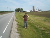
Tim finding the right spot.
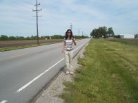
Yep, right on the edge of the road.
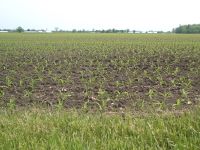
There is corn in Indiana.
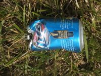
State highways, where Miller Lite goes to die.


