Difference between revisions of "2008-06-01 62 5"
From Geohashing
imported>AshleyMorton |
imported>FippeBot m (Location) |
||
| (3 intermediate revisions by 2 users not shown) | |||
| Line 6: | Line 6: | ||
}} | }} | ||
| − | A nice quick walk from Ulsteinvik. The location was in a section of moorland just north of the main road from Ulsteinvik to Hareid. [[User:AshleyMorton|AshleyMorton]] got there earlier than he'd expected (about 15:00), so ended up sitting on a rock for an hour, reading the Economist. Dedicated to the principles of geohashing, but not really expecting to find anyone else at the site, he brought a deck of cards, and played solitaire. Lost both times. Damn | + | A nice quick walk from Ulsteinvik. The location was in a section of moorland just north of the main road from Ulsteinvik to Hareid. [[User:AshleyMorton|AshleyMorton]] got there earlier than he'd expected (about 15:00), so ended up sitting on a rock for an hour, reading the Economist. Dedicated to the principles of geohashing, but not really expecting to find anyone else at the site, he brought a deck of cards, and played solitaire. Lost both times. Damn. |
<gallery widths="150px" heights="100px" perrow="3"> | <gallery widths="150px" heights="100px" perrow="3"> | ||
| Line 16: | Line 16: | ||
Image:2006-06-01_62_5_r.jpg|Until I realised that there was a light fixture on the side of the path - turns out this path is a lit trail for wintertime cross-country skiing. Huh. | Image:2006-06-01_62_5_r.jpg|Until I realised that there was a light fixture on the side of the path - turns out this path is a lit trail for wintertime cross-country skiing. Huh. | ||
Image:2006-06-01_62_5_g.jpg|Now we're off trail for the last 400m or so. The little creek doesn't look like much, until I realise that there's one every 6 feet. This place was not so great the day after a rainfall! | Image:2006-06-01_62_5_g.jpg|Now we're off trail for the last 400m or so. The little creek doesn't look like much, until I realise that there's one every 6 feet. This place was not so great the day after a rainfall! | ||
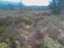
| − | Image:2006-06-01_62_5_h.jpg|Okay, made it! This looks | + | Image:2006-06-01_62_5_h.jpg|Okay, made it! This looks Northwest. |
| − | Image:2006-06-01_62_5_i.jpg| | + | Image:2006-06-01_62_5_i.jpg|North. |
| − | Image:2006-06-01_62_5_j.jpg| | + | Image:2006-06-01_62_5_j.jpg|Northeast. |
| − | Image:2006-06-01_62_5_k.jpg| | + | Image:2006-06-01_62_5_k.jpg|East. |
Image:2006-06-01_62_5_l.jpg|Down. | Image:2006-06-01_62_5_l.jpg|Down. | ||
Image:2006-06-01_62_5_m.jpg|Oops, lost the plot there - Uh... South-ish. | Image:2006-06-01_62_5_m.jpg|Oops, lost the plot there - Uh... South-ish. | ||
| Line 29: | Line 29: | ||
</gallery> | </gallery> | ||
| + | |||
| + | [[Category:Expeditions]] | ||
| + | [[Category:Expeditions with photos]] | ||
| + | [[Category:Coordinates reached]] | ||
| + | {{location|NO|15}} | ||
Latest revision as of 04:39, 7 August 2019
| Sun 1 Jun 2008 in 62,5: 62.3491079, 5.9162389 geohashing.info google osm bing/os kml crox |
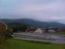
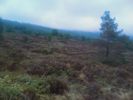
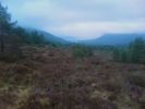
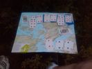
A nice quick walk from Ulsteinvik. The location was in a section of moorland just north of the main road from Ulsteinvik to Hareid. AshleyMorton got there earlier than he'd expected (about 15:00), so ended up sitting on a rock for an hour, reading the Economist. Dedicated to the principles of geohashing, but not really expecting to find anyone else at the site, he brought a deck of cards, and played solitaire. Lost both times. Damn.
I'm pretty sure this qualifies as "stupidly grinning" - That's me. (AshleyMorton)
