Difference between revisions of "2008-06-06 42 -71"
(→AHecht 1:15pm EDT) |
imported>Ahecht (→AHecht 1:15pm EDT: Added GPS screenshot (forgot to download it before)) |
||
| Line 31: | Line 31: | ||
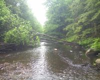
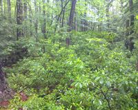
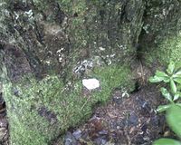
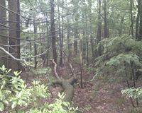
Image:Pathback.jpg|Finally, here is the back back to the river from the geohash. Just think *squish* *squish* *squish* and you'll have a pretty good idea of what the walk back was like. After getting back the car and changing shoes, I went to the nearby Panda Wok restaurant and got pretty good chinese food for lunch. | Image:Pathback.jpg|Finally, here is the back back to the river from the geohash. Just think *squish* *squish* *squish* and you'll have a pretty good idea of what the walk back was like. After getting back the car and changing shoes, I went to the nearby Panda Wok restaurant and got pretty good chinese food for lunch. | ||
| + | |||
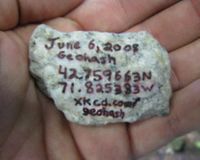
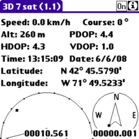
| + | Image:Snap-C473188F.png|Here is the proof I reached the spot: a screenshot from the CotoGPS program running on my Palm Centro. | ||
</gallery> | </gallery> | ||
Revision as of 22:12, 9 June 2008
| Fri 6 Jun 2008 in 42,-71: 42.7596630, -71.8253824 geohashing.info google osm bing/os kml crox |
About
This hash is located between Greenville, NH and New Ipswich, NH in the Boston, Massachusetts graticle across the Souhegan River from Rte 123.
Expeditions
AHecht 1:15pm EDT
See story in gallery below.
- GeoSquishing
These coordinates are 15 minutes from my office. I didn't find out the coordinates until I was already at work, so I had to make due with what I had with me. I didn't have a camera or separate GPS, so I had to use my phone as a camera and GPS unit (using a bluetooth GPS radio). I put on my emergency rain pants and waterproof boots from my car and headed out. The easiest access to the cache was through a backyard that was nicely mowed all the way to the river. However, not wanting to tresspass, I bushwacked my way down to the banks of the Souhegan.
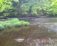
After getting to the river, this is what I was faced with. I was able to get half-way across without any trouble, but the water was too deep to get across the second half dry. After walking up and down the shore, trying to find a better crossing, I decided to go for it and wade in. My waterproof boots quickly became filled with water, and of course the water wouldn't drain out.

