Difference between revisions of "2008-06-14 39 -105"
imported>Rocketman1882 |
m |
||
| (8 intermediate revisions by 7 users not shown) | |||
| Line 12: | Line 12: | ||
= Summary = | = Summary = | ||
| − | The | + | The [[Denver West, Colorado|Denver West]] location today ({{egl|2008-06-14|39|-106|text=39.806746°,-105.038887°}}) was reached by four people (see below). The coordinates ended up in the middle of Jim Baker Reservoir. |
The four of us parked in a parking lot on the South West side of the lake ([http://maps.google.com/maps?f=q&hl=en&geocode=&q=39.805036,+-105.042997&ie=UTF8&ll=39.805041,-105.042987&spn=0.009759,0.018754&t=h&z=16&iwloc=addr Here]) and met up on a little land finger approximatly 102 meters away from the point ([http://maps.google.com/?ie=UTF8&q=loc:39.80759235,-105.03936052&ll=39.806632,-105.039146&spn=0.004879,0.009377&t=h&z=17&iwloc=addr Here]). The exact point would have been reached if swimming or boating had been legal on the lake. | The four of us parked in a parking lot on the South West side of the lake ([http://maps.google.com/maps?f=q&hl=en&geocode=&q=39.805036,+-105.042997&ie=UTF8&ll=39.805041,-105.042987&spn=0.009759,0.018754&t=h&z=16&iwloc=addr Here]) and met up on a little land finger approximatly 102 meters away from the point ([http://maps.google.com/?ie=UTF8&q=loc:39.80759235,-105.03936052&ll=39.806632,-105.039146&spn=0.004879,0.009377&t=h&z=17&iwloc=addr Here]). The exact point would have been reached if swimming or boating had been legal on the lake. | ||
| − | Two people | + | Two people brought beer (legal in the park if in cans) and one brought cookies! We chatted for a bit, watched several fish jump and several geese swim around, then parted our own ways. |
== Geohashers == | == Geohashers == | ||
Total: 4 | Total: 4 | ||
| − | *Mike | + | *[[User:Mgashwood|Mike]] |
*Michael | *Michael | ||
| − | *Joel | + | *Joel |
| − | * | + | *Arne |
== Pictures == | == Pictures == | ||
| Line 30: | Line 30: | ||
Image:20080614-Train.jpg|<center>Another Train</center> | Image:20080614-Train.jpg|<center>Another Train</center> | ||
</gallery> | </gallery> | ||
| + | |||
| + | :I'll try to get my pictures uploaded soon. | ||
== Discussion == | == Discussion == | ||
| Line 45: | Line 47: | ||
SW - The southwest location is right in the middle of Jim Baker Reservoir. We could easily meet out one of those little land tendrils going out to the middle of the reservoir and play games. It's in Avarda, so it's close to a lot of people wanting to travel in the city of Denver. If someone wants to carpool, let's start a little thing for that too. - Michael | SW - The southwest location is right in the middle of Jim Baker Reservoir. We could easily meet out one of those little land tendrils going out to the middle of the reservoir and play games. It's in Avarda, so it's close to a lot of people wanting to travel in the city of Denver. If someone wants to carpool, let's start a little thing for that too. - Michael | ||
* I'm in Golden, so it's only a hop, skip, and a jump away. If you need a ride, drop me a line [mailto:mgashwood@hotmail.com here]. I can handle three comfortably. -Mike | * I'm in Golden, so it's only a hop, skip, and a jump away. If you need a ride, drop me a line [mailto:mgashwood@hotmail.com here]. I can handle three comfortably. -Mike | ||
| − | |||
| − | |||
[[Category:Expeditions]] | [[Category:Expeditions]] | ||
[[Category:Expeditions with photos]] | [[Category:Expeditions with photos]] | ||
| + | [[Category:Coordinates not reached]] | ||
| + | [[Category:Not reached - Mother Nature]] | ||
| + | {{location|US|CO|AD}} | ||
Latest revision as of 23:08, 18 March 2022
| Sat 14 Jun 2008 in 39,-105: 39.8067463, -105.0388869 geohashing.info google osm bing/os kml crox |

39.806746°,-105.038887°
Summary
The Denver West location today (39.806746°,-105.038887°) was reached by four people (see below). The coordinates ended up in the middle of Jim Baker Reservoir.
The four of us parked in a parking lot on the South West side of the lake (Here) and met up on a little land finger approximatly 102 meters away from the point (Here). The exact point would have been reached if swimming or boating had been legal on the lake.
Two people brought beer (legal in the park if in cans) and one brought cookies! We chatted for a bit, watched several fish jump and several geese swim around, then parted our own ways.
Geohashers
Total: 4
- Mike
- Michael
- Joel
- Arne
Pictures
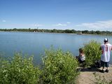
The Location is out there somewhere...(center of picture) 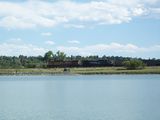
Another Train


- I'll try to get my pictures uploaded soon.
Discussion
So let's try to get a list of Participants who are interested in traveling on the 6/14 Geohash.
- Participants
- Michael
- Mike
And voting on the location:
NW:
SW: Michael, Mike
NE:
SE:
SW - The southwest location is right in the middle of Jim Baker Reservoir. We could easily meet out one of those little land tendrils going out to the middle of the reservoir and play games. It's in Avarda, so it's close to a lot of people wanting to travel in the city of Denver. If someone wants to carpool, let's start a little thing for that too. - Michael
- I'm in Golden, so it's only a hop, skip, and a jump away. If you need a ride, drop me a line here. I can handle three comfortably. -Mike