Difference between revisions of "2008-06-29 53 9"
From Geohashing
imported>Hermann (New page: {{meetup graticule | map=<map lat="53" lon="9" date="2008-06-29" /> | lat=53 | lon=9 | date=2008-06-29 }} ==About== The coordinates of this geohash are <pre> 53.608045962575794, 9.5754466...) |
imported>Hermann (→Expedition: added more images) |
||
| Line 24: | Line 24: | ||
<gallery caption="Pictures" widths="200px" heights="200px" perrow="3"> | <gallery caption="Pictures" widths="200px" heights="200px" perrow="3"> | ||
| + | Image:Hermann_Geohash_2008-06-29_53_9_road_l.jpg|Road behind the dike | ||
| + | Image:Hermann_Geohash_2008-06-29_53_9_harbor_l.jpg|''Excuse me, could you take me to 53.6080459, 9.5754466?'' | ||
| + | Image:Hermann_Geohash_2008-06-29_53_9_powernode_l.jpg|In former times, energy has been pumped out the earth like oil... | ||
| + | Image:Hermann_Geohash_2008-06-29_53_9_bike_l.jpg|[[User:Hermann|Hermann's]] bike | ||
Image:Hermann_Geohash_2008-06-29_53_9_Tower1_h.jpg|A freaking huge pylon | Image:Hermann_Geohash_2008-06-29_53_9_Tower1_h.jpg|A freaking huge pylon | ||
Image:Hermann_Geohash_2008-06-29_53_9_Tower2_l.jpg|It doesn't grow smaller if you step back | Image:Hermann_Geohash_2008-06-29_53_9_Tower2_l.jpg|It doesn't grow smaller if you step back | ||
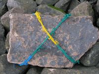
Image:Hermann_Geohash_2008-06-29_53_9_marker1_l.jpg|A marker | Image:Hermann_Geohash_2008-06-29_53_9_marker1_l.jpg|A marker | ||
| − | Image:Hermann_Geohash_2008-06-29_53_9_self_l.jpg|[[User:Hermann|Hermann]] | + | Image:Hermann_Geohash_2008-06-29_53_9_self_l.jpg|[[User:Hermann|Hermann]] thinks that geohashing is serious business |
Image:Hermann_Geohash_2008-06-29_53_9_navi_l.jpg|Proof of location | Image:Hermann_Geohash_2008-06-29_53_9_navi_l.jpg|Proof of location | ||
Image:Hermann_Geohash_2008-06-29_53_9_marker2_l.jpg|A more waterproof marker | Image:Hermann_Geohash_2008-06-29_53_9_marker2_l.jpg|A more waterproof marker | ||
| − | Image:Hermann_Geohash_2008-06-29_53_9_ships_l.jpg|'' | + | Image:Hermann_Geohash_2008-06-29_53_9_ships_l.jpg|''Hey, you, over there! Do you know geohashing?'' |
| + | Image:Hermann_Geohash_2008-06-29_53_9_sheep_l.jpg|Baaa | ||
</gallery> | </gallery> | ||
[[Category:Expeditions]] | [[Category:Expeditions]] | ||
Revision as of 17:21, 29 June 2008
| Sun 29 Jun 2008 in 53,9: 53.6080460, 9.5754466 geohashing.info google osm bing/os kml crox |
About
The coordinates of this geohash are
53.608045962575794, 9.575446623441385
It's in the middle of the river Elbe.
Expedition
Hermann was there:
detailed information will follow
Technical details:
- Trip: 26.87 km
- Time: 1:42:33 h
- Mean speed: 15.72 km/h
- Pictures
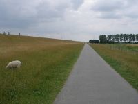
Road behind the dike
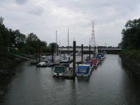
Excuse me, could you take me to 53.6080459, 9.5754466?
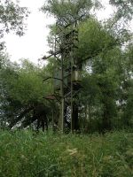
In former times, energy has been pumped out the earth like oil...
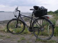
Hermann's bike
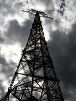
A freaking huge pylon
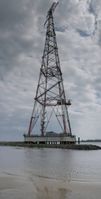
It doesn't grow smaller if you step back
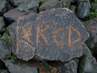
A marker
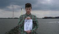
Hermann thinks that geohashing is serious business

Proof of location
A more waterproof marker
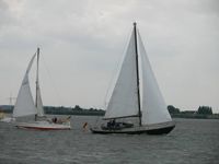
Hey, you, over there! Do you know geohashing?
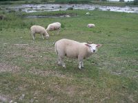
Baaa


