Difference between revisions of "2008-08-09 39 -77"
From Geohashing
imported>FippeBot m (Location) |
|||
| (7 intermediate revisions by 2 users not shown) | |||
| Line 1: | Line 1: | ||
| − | [[Image: | + | {{meetup graticule |
| − | [[Image: | + | | map=<map lat="39" lon="-77" date="2008-08-09"/> |
| − | [[Image: | + | | lat=39 |
| + | | lon=-77 | ||
| + | | date=2008-08-09 | ||
| + | }} | ||
| + | |||
| + | 2008-08-09 | ||
| + | |||
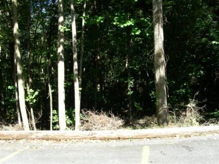
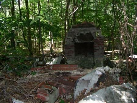
| + | [[User:chuckrex|Chuckrex]] went to the spot (which was in some trees just off the parking lot of a Moose Lodge) and marveled at the ruin he found very nearby. Fascinating. Later, he was joined by a family of four, who regularly geo-cached and were trying some geo-hashing for a change. Photo of the daugher, the instigator, included below. | ||
| + | |||
| + | [[Image:2008-08-09Frederick-meetup-onhash.jpg]] | ||
| + | [[Image:2008-08-09Frederick-meetup-fromparkinglot.jpg]] | ||
| + | [[Image:2008-08-09Frederick-meetup-.jpg]] | ||
| + | |||
| + | [[Category:Expeditions]] | ||
| + | [[Category:Coordinates reached]] | ||
| + | {{location|US|MD|MO}} | ||
Latest revision as of 06:20, 7 August 2019
| Sat 9 Aug 2008 in 39,-77: 39.0913829, -77.0585948 geohashing.info google osm bing/os kml crox |
2008-08-09
Chuckrex went to the spot (which was in some trees just off the parking lot of a Moose Lodge) and marveled at the ruin he found very nearby. Fascinating. Later, he was joined by a family of four, who regularly geo-cached and were trying some geo-hashing for a change. Photo of the daugher, the instigator, included below.


