Difference between revisions of "2008-10-04 -19 146"
From Geohashing
imported>Mattyk m |
m (More specific location) |
||
| (5 intermediate revisions by 3 users not shown) | |||
| Line 4: | Line 4: | ||
|lon=146 | |lon=146 | ||
|date=2008-10-04 | |date=2008-10-04 | ||
| − | }} | + | }}{{No trespassing|latitude=-19|longitude=146|date=2008-10-04|name=[[User:Mattyk|Matty]]|image=2008-10-04 -19 146.jpg}} |
<div style="font-size:200%;font-family:serif;text-decoration:underline;margin-bottom:.5em;">[[Townsville, Australia]]</div> | <div style="font-size:200%;font-family:serif;text-decoration:underline;margin-bottom:.5em;">[[Townsville, Australia]]</div> | ||
| Line 20: | Line 20: | ||
The End | The End | ||
| + | [[Image:2008-10-04 -19 146 pano.jpg|thumb|640px|left|The view from the ridge.]] | ||
| − | <div style="font-size:80%">P.S. if you have seen my [http://www.kerwin.net.au/geohashing/ unofficial reduced geohash for Townsville], you may be amused to note that the hashpoint for [http://www.kerwin.net.au/geohashing/?time=1223085600 Oct 04] was right on the side of the road at Oonoonba, so I drove past it (within around 10m) on my way to work that evening. —[[User:Mattyk|Matty]]</div> | + | <div style="font-size:80%;clear:left;">P.S. if you have seen my [http://www.kerwin.net.au/geohashing/ unofficial reduced geohash for Townsville], you may be amused to note that the hashpoint for [http://www.kerwin.net.au/geohashing/?time=1223085600 Oct 04] was right on the side of the road at Oonoonba, so I drove past it (within around 10m) on my way to work that evening. —[[User:Mattyk|Matty]]</div> |
| + | |||
[[Category:Expeditions]] | [[Category:Expeditions]] | ||
[[Category:Expeditions with photos]] | [[Category:Expeditions with photos]] | ||
[[Category:Coordinates not reached]] | [[Category:Coordinates not reached]] | ||
| − | [[Category: | + | [[Category:Not reached - No public access]] |
| + | {{location|AU|QLD|TV}} | ||
Latest revision as of 19:01, 28 September 2020
| Sat 4 Oct 2008 in -19,146: -19.4091331, 146.7639894 geohashing.info google osm bing/os kml crox |
Matty earned the No trespassing consolation prize
|

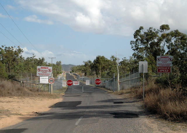
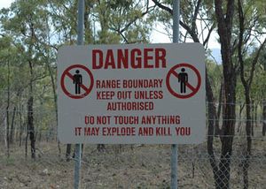
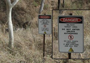
All your hashpoint are belong to ADF.
When confronted with the above barricade of death, I decided to hop out of the car and follow the fence cross-country, to see if it curved back around and possibly even let me catch a glimpse of the hashpoint.
It didn't.
So I climbed the side of a steep scrubby ridge, and was almost killed by a ferocious wild wallaby. After my long, arduous climb, I discovered a dirt road leading down the spine of the ridge, right back to the car. So I followed it.
The End
P.S. if you have seen my unofficial reduced geohash for Townsville, you may be amused to note that the hashpoint for Oct 04 was right on the side of the road at Oonoonba, so I drove past it (within around 10m) on my way to work that evening. —Matty


