Difference between revisions of "2008-11-02 32 -110"
imported>KarMann (Tucson geohash reached) |
imported>KarMann (add photos) |
||
| Line 14: | Line 14: | ||
==Photos== | ==Photos== | ||
| − | ... | + | <gallery> |
| + | Image:2008-11-02 32 -110 1741c.jpg|GPS and map in hand | ||
| + | Image:2008-11-02 32 -110 1747a.jpg|GPS on bike wheel | ||
| + | Image:2008-11-02 32 -110 1748a.jpg|Bike leaning in the gully where I had to abandon it for the last few yards | ||
| + | </gallery> | ||
[[Category:Expeditions]] | [[Category:Expeditions]] | ||
Revision as of 05:53, 3 November 2008
| Sun 2 Nov 2008 in 32,110: 32.0616062, 110.7168737 geohashing.info google osm bing/os kml crox |
About
Sunday's geohash was in the Vail, Arizona area, behind & between the subdivisions around Cienega High School. It was at the bottom of a wash, with a few dirt bike trails passing through the vicinity. However, being somewhat off those trails, and the considerable underbrush, made it somewhat of a challenge. Qualifying for MNIMB Geohash? You be the judge! Personally, I'd say it was a bit weak. But the paths down & up the wash were somewhat difficult, as was the shrubbery at the bottom. I ended up going around in circles a bit around the geohash, due to an old GPS without DGPS, which was good in that I found the clic eraser that had fallen out of my pocket last time around, and made it easier to find my bike where I'd left it in a little gully when the going got too rough.
People
One person (around 5 PM) showed up.
Photos
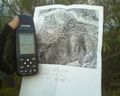
GPS and map in hand
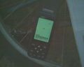
GPS on bike wheel
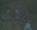
Bike leaning in the gully where I had to abandon it for the last few yards


