Difference between revisions of "2009-03-22 48 8"
From Geohashing
imported>Ekorren m (→Tracklog: (everything else will be done later)) |
imported>Ekorren (→Gallery) |
||
| Line 15: | Line 15: | ||
== Gallery == | == Gallery == | ||
| − | |||
| − | |||
<gallery> | <gallery> | ||
| + | Image:2009-03-22_48_8_Ammer.jpg|Along the Ammer | ||
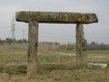
| + | Image:2009-03-22_48_8_Deckenpfronn_Rathaus.jpg|Town hall of hash village. Nothing special. | ||
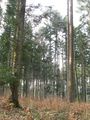
| + | Image:2009-03-22_48_8_WayToForest.jpg|The hash is in there | ||
| + | Image:2009-03-22_48_8_Tiefengrubenweg.jpg|''Deep pits way'' leads to the hash. | ||
| + | Image:2009-03-22_48_8_Hash.jpg|view on hash | ||
| + | Image:2009-03-22_48_8_Sky.jpg|view from hash | ||
| + | Image:2009-03-22_48_8_Pi.jpg|An ancient case of [[Image:EasyAsPi.PNG|30px]]! (keep guessing - I know what it's meant to be :P) | ||
| + | Image:2009-03-22_48_8_GPS.jpg|yes, yes, it's here. | ||
</gallery> | </gallery> | ||
Revision as of 12:04, 23 March 2009
| Sun 22 Mar 2009 in Pforzheim: 48.6411888, 8.8055127 geohashing.info google osm bing/os kml crox |
Location
The hash is in a forest area near Deckenpfronn, in the Oberes Gäu hills.
Expedition by Ekorren
Been there. Report will follow, but won't be one of the more interesting ones, sorry.
Gallery
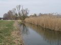
Along the Ammer
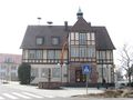
Town hall of hash village. Nothing special.
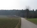
The hash is in there
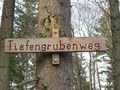
Deep pits way leads to the hash.
view on hash
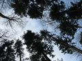
view from hash
An ancient case of
 ! (keep guessing - I know what it's meant to be :P)
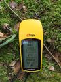
yes, yes, it's here.


Tracklog
... is here.