2009-04-18 52 7
| Sat 18 Apr 2009 in 52,7: 52.0845888, 7.8377370 geohashing.info google osm bing/os kml crox |
Plan
What was it going to be? A pretty southeastern hash means 53 5 is reachable. But that one is in a canal. I could bring swimming gear, but night temperatures are still about 4°C and the water probably isn't a lot more than 8 or maybe 10°C. Common sense tells me not to try that.
I also still haven't been to 52 5. What about that then? It's inside a national park with a 7 euro entrance fee. And I heard sunny saturdays are very crowded there. Since my money is pretty short... Sadly that also takes out 53 4. The hash was on Texel, but getting there would take 5 hours and somewhere between 50 and 60 euro for a return trip.
Of course 52 6 is way too boring, since that is only 3 fields away from last mondays hash.
Leaves 52 7. On a road. Reachable. Not very interesting. But! It is actually fairly close to the largest amount of hills in my neighbourhood, and I have found some tracks in that area with promising names like "Teutoburger climbing route". Click So lets combine (part) of one of those with the hash. Of course this hilly area only starts 60km east of where I live.
Achievements
Expedition
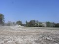
Tractor spraying... dust.
Really. I hope it doesn't kill me.
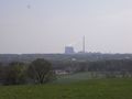
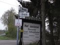
Typical german landmark.

Success!
X marks the spot. Bike in the background.
X marks the spot. I came from there.

Happy hasher with sunlotion on his face.
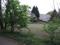
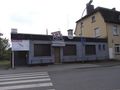
House just south of the hash. (nr24)

Hasher that used camera as mirror.

Really! With the faces and everything.
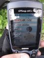
Time&date.
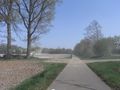
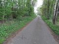
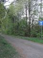
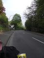
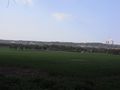
The hash was on the road to 23.
It was a dead end according to this sign.
Historical (will explain in story)
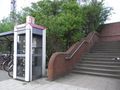
Phone booth and stairs to traintracks.
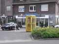
Another phone booth in Lengerich. Hey. That's a dutch numberplate.
I came from down there.
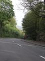
I mean there. The sign says 12%
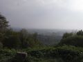
And just 100m further there was this viewpoint.
Landmark from the other side.
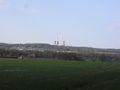
Wider view.
Ladybug. This was the best of 5 tries to make a proper picture of it. Of course I didn't stop cycling because of it.
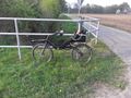
The bike! I nearly forgot to take a picture of it.


