2009-04-23 48 -122
| Thu 23 Apr 2009 in Bellingham: 48.6592781, -122.7917673 geohashing.info google osm bing/os kml crox |
Contents
Location
In woods of unknown ownership on a hilltop near Doebay on Orcas Island. Orcas is a horseshoe-shaped island in the Strait of Juan de Fuca, between Washingston State in the US and Vancouver Island in Canada. It is accessible by a two stage ferry trip, via San Juan Island.
Planning
The 235 km each way bike trip from Vancouver is more than Robyn wants to tackle, so she is considering driving aross the border to park at Anacortes, the ferry terminal. I have a ferry schedule somewhere so I'll save this and go look for it.
- Take 3:30 ferry from Anacortes to Orcas (arrive Orcas 4:45)
- Bike 33 km to Point Lawrence Road
- Hike 1.5 km up hill to geohash
- Camp!
- Bike back to ferry terminal for 10:20 am ferry
- Arrive Anacortes 11:40 next day
Expedition
Robyn
I'm too tired to write this up yet. I'll upload a photo and do the rest ... later. -Robyn 02:03, 25 April 2009 (UTC)
Rhonda
Driving to Anacortes
Orcas Island
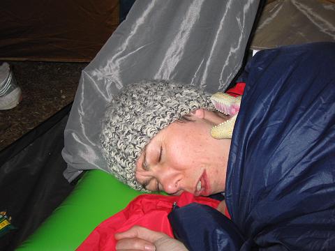
Camping
Dinosaurs aren't very cuddly for sleeping with.
Back to the ferry
Heading home
After
Just got back. Rhonda, don't look at where today's Bellingham geohash is. You'll so kick yourself for us not finding an Internet cafe in Anacortes. We should have asked those ladies iPhones on the ferry!
Augh!!! -- Rhonda 23:03, 24 April 2009 (UTC)
