Difference between revisions of "2009-04-27 33 -84"
From Geohashing
(New page: {{meetup graticule | map=<map lat="33" lon="-84" date="2009-04-27" /> | lat=33 | lon=-84 | date=2009-04-27 | graticule_name=Atlanta | graticule_link=Atlanta, Georgia }} == Graticule == ...) |
(→Gallery) |
||
| Line 25: | Line 25: | ||
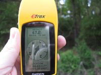
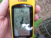
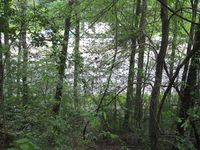
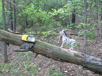
<gallery caption="Photo Gallery" widths="200px" heights="200px" perrow="3"> | <gallery caption="Photo Gallery" widths="200px" heights="200px" perrow="3"> | ||
Image:2009042733-84NW01.JPG | | Image:2009042733-84NW01.JPG | | ||
| + | Image:2009042733-84NW02.JPG | | ||
| + | Image:2009042733-84NW03.JPG | | ||
| + | Image:2009042733-84NW04.JPG | | ||
| + | Image:2009042733-84NW05.JPG | | ||
| + | Image:2009042733-84NW06.JPG | | ||
</gallery> | </gallery> | ||
Revision as of 15:05, 28 April 2009
| Mon 27 Apr 2009 in Atlanta: 33.6634049, -84.3520432 geohashing.info google osm bing/os kml crox |
Graticule
About
The only way to reach this Geohash point is by driving. Interstate Highway law requires 100 feet controlled access on either side of the interstate [1]. I was hoping when I was driving to this hash point that, the hash point was inside this fence. I was in luck.
Expedition
NWoodruff
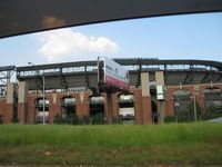
Gallery
- Photo Gallery


Achievements
NWoodruff earned the Land geohash achievement
|