Difference between revisions of "2009-04-27 33 -84"
From Geohashing
imported>NWoodruff m (→Gallery) |
imported>NWoodruff m (→Gallery) |
||
| Line 29: | Line 29: | ||
Image:2009042733-84NW04.JPG | The hill I had to climb up from the interstate. | Image:2009042733-84NW04.JPG | The hill I had to climb up from the interstate. | ||
Image:2009042733-84NW05.JPG | The eTrex on the actual hash spot. | Image:2009042733-84NW05.JPG | The eTrex on the actual hash spot. | ||
| − | Image:2009042733-84NW06.JPG | | + | Image:2009042733-84NW06.JPG | The Atlanta Braves were playing St Louis at the Ted. Unfortunately the Bravos lost. |
</gallery> | </gallery> | ||
Revision as of 15:19, 28 April 2009
| Mon 27 Apr 2009 in Atlanta: 33.6634049, -84.3520432 geohashing.info google osm bing/os kml crox |
Graticule
About
The only way to reach this Geohash point is by driving. Interstate Highway law requires 100 feet controlled access on either side of the interstate [1]. I was hoping when I was driving to this hash point that, the hash point was inside this fence. I was in luck.
Expedition
NWoodruff
Gallery
- Photo Gallery
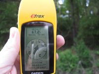
67 feet to go into the woods, almost straight up.
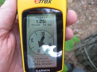
1.25 feet to go. Close enough.

Me at the hash point.
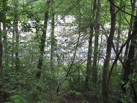
The hill I had to climb up from the interstate.
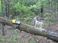
The eTrex on the actual hash spot.
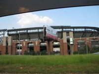
The Atlanta Braves were playing St Louis at the Ted. Unfortunately the Bravos lost.


Achievements
NWoodruff earned the Land geohash achievement
|