Difference between revisions of "2009-06-28 50 -1"
imported>Sermoa m (Add bus prices.) |
imported>Sermoa (Add a picture of the real life google pin for people to look out for!) |
||
| Line 28: | Line 28: | ||
Close to the M27. | Close to the M27. | ||
| + | |||
| + | == How to know where the event is == | ||
| + | |||
| + | There are likely to be plenty of people on the recreation ground who are not there for the geohash! You will recognise me ([[User:Sermoa|Sermoa]]) because i'll be sitting next to this: | ||
| + | |||
| + | [[Image:Real-life-google-pin.jpg|A real-life google pin i've made especially for the Hedge End meetup!]] | ||
| + | |||
| + | In the event that some people are playing cricket or whatever, we may have to move slightly away from the exact location, but we'll definitely be somewhere on the recreation ground! | ||
== How the location is calculated == | == How the location is calculated == | ||
Revision as of 19:00, 27 June 2009
| Sun 28 Jun 2009 in Southampton: 50.9102060, -1.3062207 geohashing.info google osm bing/os kml crox |
Contents
Location
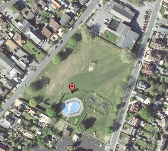
Right in the middle of Hedge End recreation ground! Plenty of space to play, pubs and cafes and shops nearby. A perfect geohash!
Participants
- User:Sermoa
- User:Macronencer - possibly - if the weather is good
Details
1.9 mile walk from Hedge End train station
2.4 mile walk from Botley train station
Bluestar 3 bus goes from Southampton to Hedge End £5.30 return or from Bitterne £4.00 return.
Close to the M27.
How to know where the event is
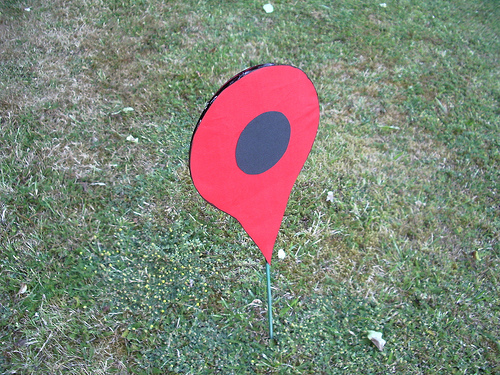
There are likely to be plenty of people on the recreation ground who are not there for the geohash! You will recognise me (Sermoa) because i'll be sitting next to this:
In the event that some people are playing cricket or whatever, we may have to move slightly away from the exact location, but we'll definitely be somewhere on the recreation ground!
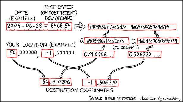
How the location is calculated
It's a combination of the date, the Dow Jones stock market data, an encryption algorithm, and a translation to geographic coordinates. We use 50, -1 to find the closest Geohash location to us, and look it up on a Google map to see where it falls. Quite often it's in the English Channel, or a field in the middle of nowhere. When it falls in a convenient place, such as Hedge End recreation ground, it's quite fun to go there to see if anyone else has come to the same place for the same reason!


