Difference between revisions of "2009-07-26 34 -84"
imported>NWoodruff m (→Gallery) |
imported>NWoodruff m (→Gallery) |
||
| Line 41: | Line 41: | ||
Image:20090726_34_-84NW14.JPG| Me with Stupid Grin™ | Image:20090726_34_-84NW14.JPG| Me with Stupid Grin™ | ||
Image:20090726_34_-84NW15.JPG| I know the sign said to stay to the trails but I was not more than 50 feet off of the trail. I really got lucky this time. | Image:20090726_34_-84NW15.JPG| I know the sign said to stay to the trails but I was not more than 50 feet off of the trail. I really got lucky this time. | ||
| − | Image:20090726_34_-84NW16.JPG| | + | Image:20090726_34_-84NW16.JPG| Picture of actual Geohash spot. |
Image:20090726_34_-84NW17.JPG| | Image:20090726_34_-84NW17.JPG| | ||
</gallery> | </gallery> | ||
Revision as of 18:02, 13 August 2009
| Sun 26 Jul 2009 in Roswell: 34.1404944, -84.0894649 geohashing.info google osm bing/os kml crox |
Graticule
About
In some woods west of Woodstock.
People
Expeditions
Gallery
- Photo Gallery
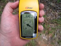
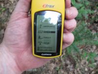
0.22 miles to go.
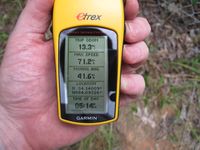
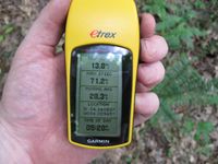
Time of the meetup.
Date of the meetup.
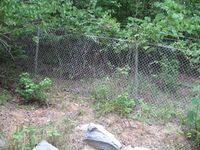
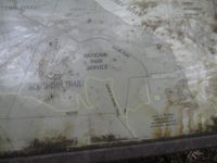
And a fence....
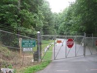
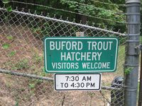
And it belongs to the Buford Trout Hatchery. Being after 4:30pm and Sunday. I don't think I am getting in there. I'll accept a No Trespassing Geohash.
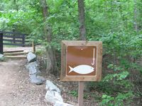
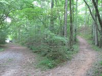
Hey! Wait a Sec... Is that a trail to go fishing?
It is! It's a public trail!
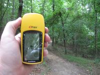
I'm in luck! The trail is going the right direction and only 0.16 miles to go.
I am right there. AND! there is that gravel road that I needed to get to from the street where the hatchery had blocked off. Can I be so lucky???
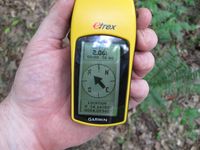
Yes! 2.06 feet to go. Close enough.
Time of the meetup.
Date of the meetup.

Me with Stupid Grin™
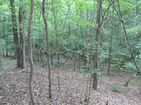
I know the sign said to stay to the trails but I was not more than 50 feet off of the trail. I really got lucky this time.
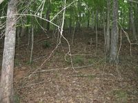
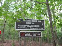
Picture of actual Geohash spot.


Achievements
NWoodruff earned the Land geohash achievement
|