Difference between revisions of "2009-07-26 34 -84"
imported>NWoodruff m (→Gallery) |
imported>NWoodruff m (→Gallery) |
||
| Line 42: | Line 42: | ||
Image:20090726_34_-84NW15.JPG| I know the sign said to stay to the trails but I was not more than 50 feet off of the trail. I really got lucky this time. | Image:20090726_34_-84NW15.JPG| I know the sign said to stay to the trails but I was not more than 50 feet off of the trail. I really got lucky this time. | ||
Image:20090726_34_-84NW16.JPG| Picture of actual Geohash spot. | Image:20090726_34_-84NW16.JPG| Picture of actual Geohash spot. | ||
| − | Image:20090726_34_-84NW17.JPG| | + | Image:20090726_34_-84NW17.JPG| Here is where the trail and the gravel road meet. And to the left you can see the gravel road entrance into the fish hatchery. No fences were climbed in making this Geohash. |
</gallery> | </gallery> | ||
Revision as of 18:06, 13 August 2009
| Sun 26 Jul 2009 in Roswell: 34.1404944, -84.0894649 geohashing.info google osm bing/os kml crox |
Graticule
About
In some woods west of Woodstock.
People
Expeditions
Gallery
- Photo Gallery
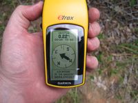
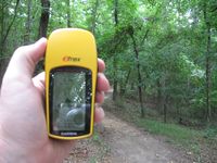
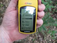
0.22 miles to go.
Time of the meetup.
Date of the meetup.
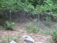
And a fence....
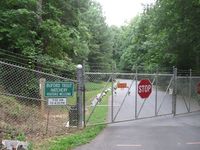
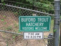
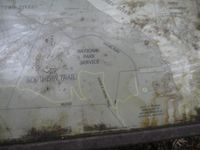
And it belongs to the Buford Trout Hatchery. Being after 4:30pm and Sunday. I don't think I am getting in there. I'll accept a No Trespassing Geohash.
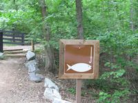
Hey! Wait a Sec... Is that a trail to go fishing?
It is! It's a public trail!
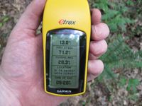
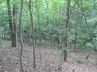
I'm in luck! The trail is going the right direction and only 0.16 miles to go.
I am right there. AND! there is that gravel road that I needed to get to from the street where the hatchery had blocked off. Can I be so lucky???
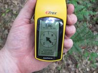
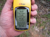
Yes! 2.06 feet to go. Close enough.
Time of the meetup.
Date of the meetup.

Me with Stupid Grin™
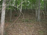
I know the sign said to stay to the trails but I was not more than 50 feet off of the trail. I really got lucky this time.
Picture of actual Geohash spot.
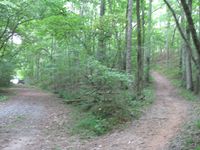
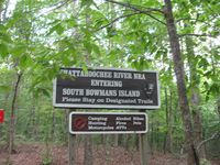
Here is where the trail and the gravel road meet. And to the left you can see the gravel road entrance into the fish hatchery. No fences were climbed in making this Geohash.


Achievements
NWoodruff earned the Land geohash achievement
|