Difference between revisions of "2009-08-02 49 -114"
imported>Joannac m (typo) |
imported>Elbie |
||
| Line 12: | Line 12: | ||
==Expedition== | ==Expedition== | ||
| − | + | <gallery> | |
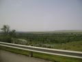
| − | + | Image:2009-08-02 49 -114 smallCoulee.jpg | I set out with my parents in their car around 13:00. The terrain began pretty much like this: farms, with the occasional coulee. | |
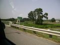
| − | + | Image:2009-08-02 49 -114 prairie.jpg | Mostly, though, it was flat. | |
| − | + | Image:2009-08-02 49 -114 fortMac.jpg | Soon we arrived in Fort Macleod, named after the fort to the right. | |
| + | Image:2009-08-02 49 -114 downtownMac.jpg | It's a small crap-town outside of Lethbridge, a small crap-city. Fort Mac is only really notable for its fort, its "historic" decrepit buildings, and being a filming site for ''Brokeback Mountain''. | ||
| + | Image:2009-08-02 49 -114 prairie2.jpg | Leaving Fort Mac, there was more prairie! | ||
| + | Image:2009-08-02 49 -114 cows.jpg | Sometimes the prairie even had cows on it! | ||
| + | Image:2009-08-02 49 -114 windmills.jpg | As we started to approach the foothills, we started seeing more windmills. These here provide energy for Calgary. | ||
| + | Image:2009-08-02 49 -114 blood.jpg | We then passed through the Blood Reserve, which makes up a large portion of the Pincher Creek graticule. | ||
| + | Image:2009-08-02 49 -114 coulee2.jpg | Another coulee. | ||
| + | Image:2009-08-02 49 -114 pincherCreek.jpg | The Pincher Creek! | ||
| + | </gallery> | ||
==Ribbons== | ==Ribbons== | ||
Revision as of 03:43, 4 August 2009
| Sun 2 Aug 2009 in 49,-114: 49.5333294, -114.1774206 geohashing.info google osm bing/os kml crox |
Contents
Location
On a farm near Lundbreck Falls
Participants
- Elbie and her parents.
Expedition
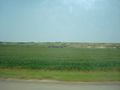
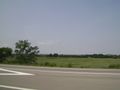
I set out with my parents in their car around 13:00. The terrain began pretty much like this: farms, with the occasional coulee.
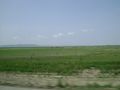
Mostly, though, it was flat.
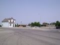
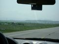
Soon we arrived in Fort Macleod, named after the fort to the right.
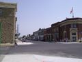
It's a small crap-town outside of Lethbridge, a small crap-city. Fort Mac is only really notable for its fort, its "historic" decrepit buildings, and being a filming site for Brokeback Mountain.
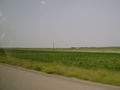
Leaving Fort Mac, there was more prairie!
Sometimes the prairie even had cows on it!
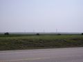
As we started to approach the foothills, we started seeing more windmills. These here provide energy for Calgary.
We then passed through the Blood Reserve, which makes up a large portion of the Pincher Creek graticule.
Another coulee.
The Pincher Creek!


Ribbons
Pending