Difference between revisions of "2009-08-03 40 -89"
imported>Dvdllr (→Photos: Added photo captions.) |
imported>Dvdllr (→Location) |
||
| Line 5: | Line 5: | ||
}} | }} | ||
== Location == | == Location == | ||
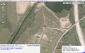
| − | The geohash was in a | + | The geohash was on the intersection of two paths in a field on the west side of Bloomington, Illinois. |
== Participants == | == Participants == | ||
Revision as of 17:45, 4 August 2009
| Mon 3 Aug 2009 in 40,-89: 40.4658008, -89.0357201 geohashing.info google osm bing/os kml crox |
Location
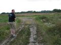
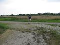
The geohash was on the intersection of two paths in a field on the west side of Bloomington, Illinois.
Participants
- Dvdllr & wife
Plans
Little to no plans on this one! I ran the geohash webpage for the Peoria graticule at about 6:30 PM, and was on the road at 6:45 PM. I wanted to go because the hashpoint was on an accessible road/path, which is rare in this graticule because of all the farms. I printed off driving directions, an overhead view of the hashpoint itself, and grabbed my stack of Ambassador forms.
Expedition
pending
Photos
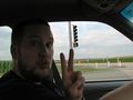
Attempt number 2, in as many days
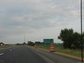
On the road to Bloomington from Morton
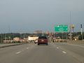
Downtown Bloomington
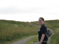
The lovely Rachel, on the path to the hashpoint
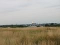
The field, with Bloomington in the background
There it is, up ahead!
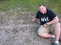
First successful geohash!

Ridiculous grin, and today's newspaper
...was here.
Hooray!
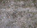
Proof of location


Achievements
Dvdllr earned the Land geohash achievement
|
Dvdllr earned the No Batteries Geohash Achievement
|