Difference between revisions of "2009-08-27 49 8"
imported>Ilpadre (time to go) |
imported>Ilpadre (done) |
||
| Line 15: | Line 15: | ||
== Expedition == | == Expedition == | ||
| − | '''Expedition total:''' | + | '''Expedition total:''' 2.2 hours, walked 19.5 km |
| − | + | The coordinates were in perfect distance to beat my yet longest walk geohash, and I returned early enough from work to get there and return home before sundown (about 90% of the way to the hash and back aren't illuminted by street lights). I started my expedition by following the southbound train tracks until I reached Sandhausen. From there, the hashpoint was easy to find - I just had to follow the L598, a street starting in Heidelberg and leading through Sandhausen to St. Leon-Rot. The hashpoint was just 20 m off the street into a forest. | |
| + | |||
| + | I didn't want to take the same way back (even though it's a really beautiful route without any cars around) and followed field tracks along the L598, taking a slight detour of about a km at a point where I couldn't safely cross the street and had to turn west. | ||
== Photos == | == Photos == | ||
<gallery> | <gallery> | ||
| + | Image:2009-08-27 49 8 grapes.jpg | ||
| + | Image:2009-08-27 49 8 tracks.jpg|Almost all of the way to the hash looked like this | ||
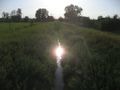
| + | Image:2009-08-27 49 8 creek.jpg | ||
| + | Image:2009-08-27 49 8 marker.jpg|Google Maps didn't know about that roundabout | ||
| + | Image:2009-08-27 49 8 pano roundabout.jpg | ||
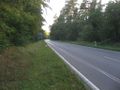
| + | Image:2009-08-27 49 8 l598.jpg|Street leading to the coordinates | ||
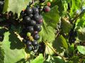
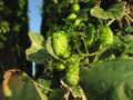
| + | Image:2009-08-27 49 8 hop yard.jpg | ||
| + | Image:2009-08-27 49 8 hop cones.jpg | ||
| + | Image:2009-08-27 49 8 200 m to go.jpg|200 m to go | ||
| + | Image:2009-08-27 49 8 stupidgrin.jpg|Obligatory | ||
| + | Image:2009-08-27 49 8 longshadows.jpg|Getting on my way back home | ||
| + | Image:2009-08-27 49 8 zu verkaufen.jpg|Why doesn't anybody want to buy this beauty? | ||
| + | Image:2009-08-27 49 8 power lines.jpg|Power lines | ||
| + | Image:2009-08-27 49 8 substation.jpg|Substation | ||
| + | Image:2009-08-27 49 8 high voltage.jpg|''when we touch<br>when we kiss'' | ||
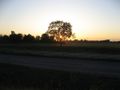
| + | Image:2009-08-27 49 8 sunset.jpg | ||
</gallery> | </gallery> | ||
| − | [[Category: | + | [[Category:Expeditions]] |
| + | [[Category:Coordinates reached]] | ||
| + | [[Category:Expeditions with photos]] | ||
Revision as of 19:56, 27 August 2009
| Thu 27 Aug 2009 in 49,8: 49.3297327, 8.6587506 geohashing.info google osm bing/os kml crox |
Contents
Location
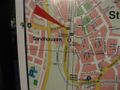
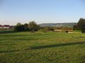
In a forest near Sandhausen, about 9 km south of Heidelberg.
Participants
Expedition
Expedition total: 2.2 hours, walked 19.5 km
The coordinates were in perfect distance to beat my yet longest walk geohash, and I returned early enough from work to get there and return home before sundown (about 90% of the way to the hash and back aren't illuminted by street lights). I started my expedition by following the southbound train tracks until I reached Sandhausen. From there, the hashpoint was easy to find - I just had to follow the L598, a street starting in Heidelberg and leading through Sandhausen to St. Leon-Rot. The hashpoint was just 20 m off the street into a forest.
I didn't want to take the same way back (even though it's a really beautiful route without any cars around) and followed field tracks along the L598, taking a slight detour of about a km at a point where I couldn't safely cross the street and had to turn west.
Photos
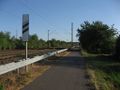
Almost all of the way to the hash looked like this
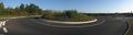
Google Maps didn't know about that roundabout
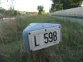
Street leading to the coordinates
200 m to go

Obligatory
Getting on my way back home

Why doesn't anybody want to buy this beauty?
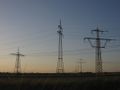
Power lines
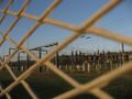
Substation
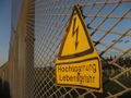
when we touch
when we kiss