Difference between revisions of "2009-08-31 50 -2"
imported>Mahahahaneapneap |
imported>FippeBot m (Location) |
||
| (5 intermediate revisions by 3 users not shown) | |||
| Line 14: | Line 14: | ||
==Expedition== | ==Expedition== | ||
| − | Mahahahaneapneap (Ali) and Blue Rise (Mike) met at Mike's house, and cycled to Poole train station, via Asda for lunch. We got the train to Wareham where we met Owen and cycled in the direction of the geohash.... | + | Mahahahaneapneap (Ali) and Blue Rise (Mike) met at Mike's house, and cycled to Poole train station, via Asda for lunch. We got the train to Wareham where we met Owen and cycled in the direction of the geohash, going down Puddletown Road, a really great straight quiet road that meant a slight detour but avoiding the main road. Cycling through Wool, stopping 4 times on the way through to argue on the correct route, we headed up through Burton, towards the hashpoint enjoying the English countryside. When we arrived at the point of road nearest our hash, we parked our bikes, and proceeded on foot... in the wrong direction!.... |
==Photos== | ==Photos== | ||
| − | <gallery> | + | <gallery perrow="4"> |
| + | Image:2009-08-31 50 -2 01.jpg|It really was a lovely road. | ||
| + | Image:DSC03818 (Custom).JPG|Mike and Owen enjoying cycling on such a lovely road. | ||
| + | Image:2009-08-31 50 -2 03.jpg|Lovely. | ||
| + | Image:2009-08-31 50 -2 04.jpg|Nice. | ||
| + | Image:2009-08-31 50 -2 05.jpg|One of the lesser used British road signs. | ||
| + | Image:2009-08-31 50 -2 07.jpg|Never seen one of these before... | ||
| + | Image:2009-08-31 50 -2 06.jpg|The tank turning area. | ||
| + | Image:2009-08-31 50 -2 08.jpg|Some nice scenery, with us in front of it. | ||
| + | Image:2009-08-31 50 -2 10.jpg|Waiting at the infamous level crossing in Wool. | ||
| + | Image:2009-08-31 50 -2 09.jpg|Wrong turning... | ||
| + | Image:2009-08-31 50 -2 11.jpg|...but a nice excuse for a photo. | ||
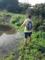
| + | Image:2009-08-31 50 -2 12.jpg|A swamp we needlessly waded through. | ||
| + | Image:2009-08-31 50 -2 13.jpg|Owen needlessly wading through a swamp. | ||
| + | Image:2009-08-31 50 -2 14.jpg|Posing on a bridge. | ||
| + | Image:2009-08-31 50 -2 15.jpg|The tree from the satellite image. | ||
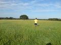
| + | Image:2009-08-31 50 -2 16.jpg|All three of us at the hash point. | ||
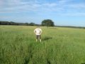
| + | Image:2009-08-31 50 -2 17.jpg|Owen at the hash point. | ||
| + | Image:2009-08-31 50 -2 18.jpg|Ali at the hash point. | ||
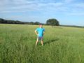
| + | Image:2009-08-31 50 -2 19.jpg|Mike at the hash point. | ||
| + | Image:2009-08-31 50 -2 20.jpg|Lying down at the hash point - a nice Facebook profile picture. | ||
| + | Image:2009-08-31 50 -2 21.jpg|Mike's thumb - he was complaining of a raptor bite, but I'm not sure if I can see it myself. | ||
| + | </gallery> | ||
| + | |||
| + | [[Category:Expeditions]] | ||
| + | [[Category:Expeditions with photos]] | ||
| + | [[Category:Coordinates reached]] | ||
| + | {{location|GB|ENG|DOR}} | ||
Latest revision as of 05:31, 8 August 2019
| Mon 31 Aug 2009 in 50,-2: 50.6765723, -2.3132829 geohashing.info google osm bing/os kml crox |
Contents
Location
In a seemingly empty field close to...nowhere; a few miles from Wool.
Participants
Expedition
Mahahahaneapneap (Ali) and Blue Rise (Mike) met at Mike's house, and cycled to Poole train station, via Asda for lunch. We got the train to Wareham where we met Owen and cycled in the direction of the geohash, going down Puddletown Road, a really great straight quiet road that meant a slight detour but avoiding the main road. Cycling through Wool, stopping 4 times on the way through to argue on the correct route, we headed up through Burton, towards the hashpoint enjoying the English countryside. When we arrived at the point of road nearest our hash, we parked our bikes, and proceeded on foot... in the wrong direction!....
Photos
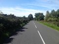
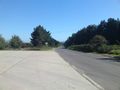
It really was a lovely road.
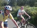
Mike and Owen enjoying cycling on such a lovely road.
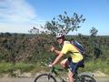
Lovely.
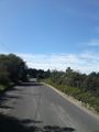
Nice.
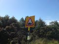
One of the lesser used British road signs.
Never seen one of these before...
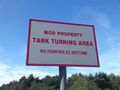
The tank turning area.
Some nice scenery, with us in front of it.
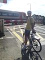
Waiting at the infamous level crossing in Wool.
Wrong turning...
...but a nice excuse for a photo.
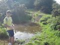
A swamp we needlessly waded through.
Owen needlessly wading through a swamp.
Posing on a bridge.
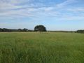
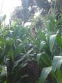
The tree from the satellite image.
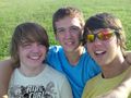
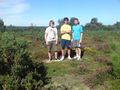
All three of us at the hash point.
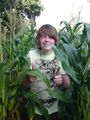
Owen at the hash point.
Ali at the hash point.
Mike at the hash point.
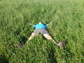
Lying down at the hash point - a nice Facebook profile picture.
Mike's thumb - he was complaining of a raptor bite, but I'm not sure if I can see it myself.

.JPG)


