Difference between revisions of "2009-09-03 -37 145"
imported>Felix Dance (Added detail) |
Felix Dance (talk | contribs) m (→Felix Dance) |
||
| (7 intermediate revisions by 4 users not shown) | |||
| Line 8: | Line 8: | ||
In a property just off Hickford Street, Reservoir. | In a property just off Hickford Street, Reservoir. | ||
| + | |||
| + | == Consecutive Geohashing == | ||
| + | |||
| + | 2009-09-03 -37 145 - I - Thursday<br/> | ||
| + | [[2009-09-04 -38 146]] - II - Friday<br/> | ||
| + | [[2009-09-05 -37 145]] - III - Saturday<br/> | ||
| + | [[2009-09-06 -37 145]] - IV - Sunday | ||
== Expedition == | == Expedition == | ||
| Line 16: | Line 23: | ||
Just before I was planning to leave after work (after a brief but intense thunderstorm passed over) I noticed that [[User:mykaDragonBlue|myka]] had left a note in the discussion page saying that he was thinking of doing this one too, so I frantically tried to arrange a meet up before heading off. | Just before I was planning to leave after work (after a brief but intense thunderstorm passed over) I noticed that [[User:mykaDragonBlue|myka]] had left a note in the discussion page saying that he was thinking of doing this one too, so I frantically tried to arrange a meet up before heading off. | ||
| − | Heading north through the city and up High street, finding the ride easy going and pretty scenic with occasional views of the city (see below), I got to the smashed glass and broken fence hotspot of Reservoir and hence the geohash. Google Maps showed the location to be just inside the front fence of a residential property, but as I approached it the GPS pointed me to a drive way inside a block of flats – 2m to the west next door. Since this was within the resolution of the GPS I took this as the point (for the pedants I did stick a leg over the fence and lean over to be over the actual point in Google Maps). The time of the geohash was 7:20pm. I took a few photos and then explored the local area – a park where there were people playing soccer, hung around the geohash point for about 20 minutes waiting to see if myka would turn up, then headed home, stopping only for a Hungry Jacks veggie burger, some cash from an ATM and a few beers at Brunswick share house on my way home. | + | Heading north through the city and up High street, finding the ride easy going and pretty scenic with occasional views of the city (see below), I got to the smashed glass and broken fence hotspot of Reservoir and hence the geohash. Google Maps showed the location to be just inside the front fence of a residential property, but as I approached it the GPS pointed me to a drive way inside a block of flats – 2m to the west next door. Since this was within the resolution of the GPS I took this as the point (for the pedants I did stick a leg over the fence and lean over to be over the actual point in Google Maps). The time of the geohash was 7:20pm. I took a few photos and then explored the local area – a park where there were people playing soccer, hung around the geohash point for about 20 minutes waiting to see if myka would turn up, then headed home, stopping only for a Hungry Jacks veggie burger, some cash from an ATM and a few beers at a Brunswick share house on my way home. |
[http://maps.google.com/maps?f=d&source=s_d&saddr=395+Bay+St,+Port+Melbourne+VIC+3207,+Australia+(Home,+Paint+and+Wallpaper)&daddr=Swanston+Street+Walk+to:Queens+Pde+to:High+St+to:Hickford+St+to:Harmer+St+to:-37.703221%C2%B0,+145.014861%C2%B0+to:Normanby+Ave+to:Stewart+St,+Brunswick+VIC+3056,+Australia+to:395+Bay+St,+Port+Melbourne+VIC+3207,+Australia+(Home,+Paint+and+Wallpaper)&hl=en&geocode=%3BFb71vv0dGgakCA%3BFdlpv_0dE2ukCA%3BFeCxwP0dUK2kCA%3BFd2ywP0dk7-kCA%3BFYm4wP0d3sKkCA%3BFcuxwP0dTcCkCA%3BFbzWv_0dT3-kCA%3B%3B&mra=mr&mrcr=1&via=1,2,3,4,5,7&dirflg=w&sll=-37.757348,144.997215&sspn=0.056594,0.077162&safe=on&ie=UTF8&ll=-37.75253,144.997215&spn=0.226391,0.308647&z=12 Here’s] my route. Total distance = 40kms. | [http://maps.google.com/maps?f=d&source=s_d&saddr=395+Bay+St,+Port+Melbourne+VIC+3207,+Australia+(Home,+Paint+and+Wallpaper)&daddr=Swanston+Street+Walk+to:Queens+Pde+to:High+St+to:Hickford+St+to:Harmer+St+to:-37.703221%C2%B0,+145.014861%C2%B0+to:Normanby+Ave+to:Stewart+St,+Brunswick+VIC+3056,+Australia+to:395+Bay+St,+Port+Melbourne+VIC+3207,+Australia+(Home,+Paint+and+Wallpaper)&hl=en&geocode=%3BFb71vv0dGgakCA%3BFdlpv_0dE2ukCA%3BFeCxwP0dUK2kCA%3BFd2ywP0dk7-kCA%3BFYm4wP0d3sKkCA%3BFcuxwP0dTcCkCA%3BFbzWv_0dT3-kCA%3B%3B&mra=mr&mrcr=1&via=1,2,3,4,5,7&dirflg=w&sll=-37.757348,144.997215&sspn=0.056594,0.077162&safe=on&ie=UTF8&ll=-37.75253,144.997215&spn=0.226391,0.308647&z=12 Here’s] my route. Total distance = 40kms. | ||
| + | |||
| + | As it happens, this was also the first of four consecutive geohashes! Read [[2009-09-04 -38 146]] for the next one. | ||
== Photos == | == Photos == | ||
| Line 28: | Line 37: | ||
Image:2009 09 03 -37 145 The Geohash Location.jpg|The geohash location itself | Image:2009 09 03 -37 145 The Geohash Location.jpg|The geohash location itself | ||
</gallery> | </gallery> | ||
| + | |||
| + | {{Bicycle geohash | ||
| + | |||
| + | | latitude = -37 | ||
| + | | longitude = 145 | ||
| + | | date = 2009-09-03 | ||
| + | | name = | ||
| + | | distance = 40kms | ||
| + | | image = | ||
| + | }} | ||
| + | |||
| + | {{consecutive geohash | ||
| + | |||
| + | | count = 4 | ||
| + | | latitude = -37 | ||
| + | | longitude = 145 | ||
| + | | date = 2009-09-03 | ||
| + | | name = [[User:Felix Dance|Felix Dance]] | ||
| + | }} | ||
[[Category: Expeditions]] | [[Category: Expeditions]] | ||
[[Category: Expeditions with photos]] | [[Category: Expeditions with photos]] | ||
[[Category: Coordinates reached]] | [[Category: Coordinates reached]] | ||
| + | {{location|AU|VIC|DA}} | ||
Latest revision as of 12:31, 27 April 2022
| Thu 3 Sep 2009 in -37,145: -37.7032204, 145.0148617 geohashing.info google osm bing/os kml crox |
Location
In a property just off Hickford Street, Reservoir.
Consecutive Geohashing
2009-09-03 -37 145 - I - Thursday
2009-09-04 -38 146 - II - Friday
2009-09-05 -37 145 - III - Saturday
2009-09-06 -37 145 - IV - Sunday
Expedition
Felix Dance
Yesterday's hash was in an almost accessible spot in the outer eastern suburbs which I briefly considered going for, but with beer to brew I decided against it. Today, however, looked even more promising - closer, closer to a public area, just me having had my bike serviced and on a day whose evening for which I had no plans.
Just before I was planning to leave after work (after a brief but intense thunderstorm passed over) I noticed that myka had left a note in the discussion page saying that he was thinking of doing this one too, so I frantically tried to arrange a meet up before heading off.
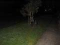
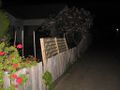
Heading north through the city and up High street, finding the ride easy going and pretty scenic with occasional views of the city (see below), I got to the smashed glass and broken fence hotspot of Reservoir and hence the geohash. Google Maps showed the location to be just inside the front fence of a residential property, but as I approached it the GPS pointed me to a drive way inside a block of flats – 2m to the west next door. Since this was within the resolution of the GPS I took this as the point (for the pedants I did stick a leg over the fence and lean over to be over the actual point in Google Maps). The time of the geohash was 7:20pm. I took a few photos and then explored the local area – a park where there were people playing soccer, hung around the geohash point for about 20 minutes waiting to see if myka would turn up, then headed home, stopping only for a Hungry Jacks veggie burger, some cash from an ATM and a few beers at a Brunswick share house on my way home.
Here’s my route. Total distance = 40kms.
As it happens, this was also the first of four consecutive geohashes! Read 2009-09-04 -38 146 for the next one.
Photos

The awesome cityscape on the way there
My bike at the geohash
GPS at the location

Felix at the geohash
The geohash location itself


This user earned the Bicycle geohash achievement
|
Felix Dance earned the Consecutive geohash achievement
|