Difference between revisions of "2009-09-08 48 8"
imported>Ekorren (skeleton only, rest will follow tomorrow) |
imported>Ekorren (Gallery) |
||
| Line 7: | Line 7: | ||
== Location == | == Location == | ||
| + | Near Dornstetten, in a dense and wet part of the Black Forest | ||
== Participants == | == Participants == | ||
| Line 16: | Line 17: | ||
== Gallery == | == Gallery == | ||
| + | |||
| + | I made one photo at every full hour (give it one or two minutes), no matter where I was at just that time. So those photos are pretty random, but give a good representation of where I passed. | ||
| + | |||
<gallery> | <gallery> | ||
| + | Image:2009-09-08_48_8_0900.jpg|At '''9:00''' I had just left home and was about to leave town. | ||
| + | Image:2009-09-08_48_8_1000.jpg|At '''10:00''' I found there was no way to the other side of this "valley", and took a route on this side. | ||
| + | Image:2009-09-08_48_8_Road_to_nowhere.jpg|We're on a road to nowhere | ||
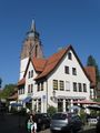
| + | Image:2009-09-08_48_8_1100_Baisingen_Kirche.jpg|At '''11:00''' I stood in front of this church at Baisingen | ||
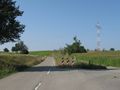
| + | Image:2009-09-08_48_8_1200.jpg|At '''12:00''' a sign warned me that there might lure kamikazeous deer around the corner. | ||
| + | Image:2009-09-08_48_8_1300.jpg|At '''13:00''' I found that, given the elevation profile, this route wasn't actually the brightest idea; and wondered what that heap in the background may be | ||
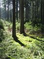
| + | Image:2009-09-08_48_8_1400.jpg|At '''14:00''' I rode through a deep forest valley and decided to go for another detour | ||
| + | Image:2009-09-08_48_8_way_to_hash.jpg|Something almost, but not quite, entirely unlike a way. | ||
| + | Image:2009-09-08_48_8_1500_hash.jpg|At '''15:00''' I was at the hash. Exactly. | ||
| + | Image:2009-09-08_48_8_GPS.jpg|Coordinates reached (given the usual GPS dance) | ||
| + | Image:2009-09-08_48_8_Dornstetten.0.jpg|A first view on Dornstetten | ||
| + | Image:2009-09-08_48_8_1600_Canape.jpg|At '''16:00''' I stood on the market square of Dornstetten and thought about getting some ice cream at this cafe. | ||
| + | Image:2009-09-08_48_8_Dornstetten.1.jpg|More impressions from Dornstetten | ||
| + | Image:2009-09-08_48_8_Dornstetten.3.jpg | ||
| + | Image:2009-09-08_48_8_Dornstetten.4.jpg | ||
| + | Image:2009-09-08_48_8_1700.jpg|At '''17:00''' I was down in the Glatt valley and just left the village of Neuneck | ||
| + | Image:2009-09-08_48_8_Glatt.1.jpg|Castle Glatt | ||
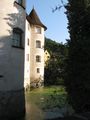
| + | Image:2009-09-08_48_8_Glatt.2.jpg | ||
| + | Image:2009-09-08_48_8_Glatt.3.jpg | ||
| + | Image:2009-09-08_48_8_1800.jpg|At '''18:00''' I just had reached the Neckar valley | ||
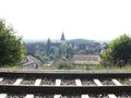
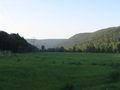
| + | Image:2009-09-08_48_8_1900.jpg|At '''19:00''' I had left Horb and wondered whether I would catch the 19:31 train at Eyach. | ||
| + | Image:2009-09-08_48_8_2000.jpg|At '''20:00''' I came home. | ||
</gallery> | </gallery> | ||
Revision as of 09:39, 9 September 2009
| Tue 8 Sep 2009 in 48,8: 48.4722325, 8.5345979 geohashing.info google osm bing/os kml crox |
Contents
Location
Near Dornstetten, in a dense and wet part of the Black Forest
Participants
Expedition
Gallery
I made one photo at every full hour (give it one or two minutes), no matter where I was at just that time. So those photos are pretty random, but give a good representation of where I passed.
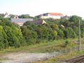
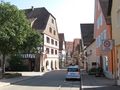
At 9:00 I had just left home and was about to leave town.
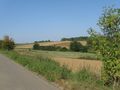
At 10:00 I found there was no way to the other side of this "valley", and took a route on this side.
We're on a road to nowhere
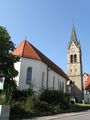
At 11:00 I stood in front of this church at Baisingen
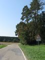
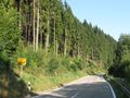
At 12:00 a sign warned me that there might lure kamikazeous deer around the corner.
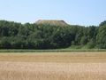
At 13:00 I found that, given the elevation profile, this route wasn't actually the brightest idea; and wondered what that heap in the background may be
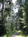
At 14:00 I rode through a deep forest valley and decided to go for another detour
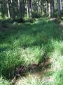
Something almost, but not quite, entirely unlike a way.
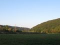
At 15:00 I was at the hash. Exactly.
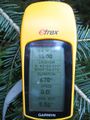
Coordinates reached (given the usual GPS dance)
A first view on Dornstetten
At 16:00 I stood on the market square of Dornstetten and thought about getting some ice cream at this cafe.
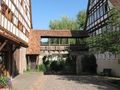
More impressions from Dornstetten
At 17:00 I was down in the Glatt valley and just left the village of Neuneck
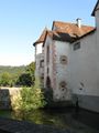
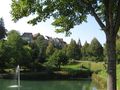
Castle Glatt
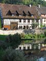
At 18:00 I just had reached the Neckar valley
At 19:00 I had left Horb and wondered whether I would catch the 19:31 train at Eyach.

At 20:00 I came home.


