Difference between revisions of "2009-09-08 49 8"
imported>Ilpadre (report :/) |
imported>FippeBot m (Location) |
||
| (5 intermediate revisions by 2 users not shown) | |||
| Line 15: | Line 15: | ||
== Expedition == | == Expedition == | ||
| − | '''Expedition total:''' 3.5 hours, walked 16 km | + | '''Expedition total:''' 3.5 hours, [[Walk Geohashes|walked]] 16 km |
| + | |||
| + | {{Blinded by Science | latitude = 49 | longitude = 8 | date = 2009-09-08 | name = [[User:ilpadre|ilpadre]] | reason = because he blindly followed outdated satellite imagery }} | ||
In short: Wanted to run and walk to the hash and back, had to stop running after 1 hour and about 10 km because I suddenly experienced massive digestive problems (after having eaten too many onions and leeks the day before). Needed 1.5 hours for the remaining 5 km to the hashpoint. Went to a point south of a distinctive parking lot, just like the satellite imagery shows, and felt lucky that the field was already harvested. Walked to a nearby tram station to find out the ticket machine only accepts coins. Walked back to a supermarket to change my 5-Euro bill into coins. Returned just in time to catch the last reasonable tram. Back home, comparing my photos to the outdated satellite imagery, I realized that in the last years, an exact copy of the parking lot I used for orientation must have been built 130 m to the east, and the other one had been replaced by two office buildings. I walked to a Potemkin hash. Oh well. | In short: Wanted to run and walk to the hash and back, had to stop running after 1 hour and about 10 km because I suddenly experienced massive digestive problems (after having eaten too many onions and leeks the day before). Needed 1.5 hours for the remaining 5 km to the hashpoint. Went to a point south of a distinctive parking lot, just like the satellite imagery shows, and felt lucky that the field was already harvested. Walked to a nearby tram station to find out the ticket machine only accepts coins. Walked back to a supermarket to change my 5-Euro bill into coins. Returned just in time to catch the last reasonable tram. Back home, comparing my photos to the outdated satellite imagery, I realized that in the last years, an exact copy of the parking lot I used for orientation must have been built 130 m to the east, and the other one had been replaced by two office buildings. I walked to a Potemkin hash. Oh well. | ||
| Line 21: | Line 23: | ||
== Photos == | == Photos == | ||
| + | <gallery> | ||
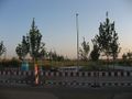
| + | Image:2009-09-08 49 8 wahlkampf1.jpg|German elections are coming up this month | ||
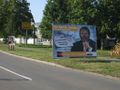
| + | Image:2009-09-08 49 8 wahlkampf2.jpg | ||
| + | Image:2009-09-08 49 8 hop.jpg|Wild hop | ||
| + | Image:2009-09-08 49 8 seckenheim.jpg|Seckenheim Town Hall | ||
| + | Image:2009-09-08 49 8 shy cat.jpg|She didn't let me touch her :( | ||
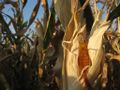
| + | Image:2009-09-08 49 8 corn.jpg | ||
| + | Image:2009-09-08 49 8 plane.jpg|Many airhashes today | ||
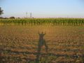
| + | Image:2009-09-08 49 8 stupidgrin.jpg|You're grinning at the wrong place, stupid! | ||
| + | Image:2009-09-08 49 8 stomp.jpg | ||
| + | Image:2009-09-08 49 8 lastview.jpg|The construction site should have made me suspicious, but I was probably too dehydrated | ||
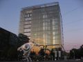
| + | Image:2009-09-08 49 8 office buildings.jpg|Fun fact: I took this picture because I liked the architecture. Turned out it's a picture of the hashpoint. | ||
| + | Image:2009-09-08 49 8 seckenheimer landstr.jpg|This way home... | ||
| + | Image:2009-09-08 49 8 sunset.jpg|...by tram | ||
| + | Image:2009-09-08 49 8 heidelberg.jpg|Back in Heidelberg | ||
| + | </gallery> | ||
| Line 27: | Line 45: | ||
[[Category:Coordinates not reached]] | [[Category:Coordinates not reached]] | ||
[[Category:Not reached - Technology]] | [[Category:Not reached - Technology]] | ||
| + | {{location|DE|BW|MA}} | ||
Latest revision as of 05:41, 8 August 2019
| Tue 8 Sep 2009 in 49,8: 49.4722325, 8.5345979 geohashing.info google osm bing/os kml crox |
Contents
Location
In a field east of Mannheim City Airport.
Participants
Expedition
Expedition total: 3.5 hours, walked 16 km
ilpadre earned the Blinded by Science Consolation Prize
|
In short: Wanted to run and walk to the hash and back, had to stop running after 1 hour and about 10 km because I suddenly experienced massive digestive problems (after having eaten too many onions and leeks the day before). Needed 1.5 hours for the remaining 5 km to the hashpoint. Went to a point south of a distinctive parking lot, just like the satellite imagery shows, and felt lucky that the field was already harvested. Walked to a nearby tram station to find out the ticket machine only accepts coins. Walked back to a supermarket to change my 5-Euro bill into coins. Returned just in time to catch the last reasonable tram. Back home, comparing my photos to the outdated satellite imagery, I realized that in the last years, an exact copy of the parking lot I used for orientation must have been built 130 m to the east, and the other one had been replaced by two office buildings. I walked to a Potemkin hash. Oh well.
Photos
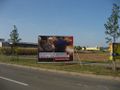
German elections are coming up this month
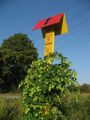
Wild hop
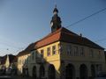
Seckenheim Town Hall
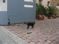
She didn't let me touch her :(
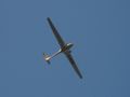
Many airhashes today

You're grinning at the wrong place, stupid!
The construction site should have made me suspicious, but I was probably too dehydrated
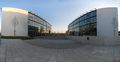
Fun fact: I took this picture because I liked the architecture. Turned out it's a picture of the hashpoint.
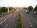
This way home...
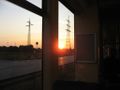
...by tram
Back in Heidelberg


