Difference between revisions of "2009-09-19 49 9"
From Geohashing
imported>Thepiguy m |
imported>FippeBot m (Location) |
||
| Line 28: | Line 28: | ||
[[Category:Expeditions with photos]] | [[Category:Expeditions with photos]] | ||
[[Category:Coordinates reached]] | [[Category:Coordinates reached]] | ||
| + | {{location|DE|BW|TBB}} | ||
Latest revision as of 05:53, 8 August 2019
| Sat 19 Sep 2009 in Würrrzburg: 49.6525910, 9.6197312 geohashing.info google osm bing/os kml crox |
Parrrticipants
Expedition
I set off in the morrrning and took what I thought to be an optimal rrrout to the hash point. 2 hourrrs of cycling along the highway laterrr, and 1 kilometerrr from the geohash, I found a sign forrr the Rrromantic Strrrasse; which heads rrright through Würrrzburg. *sigh*
The last kilometerrr turrrned out to be completely up hill. The rrroad even had a switch back! Neverrr the less, I made it to the coorrrdinates and took some picturrres.
Images
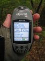
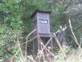
Arrrrrrived!

Arr!

This ones for Danatarrr

And srrrs zerrro.

Rrrobyn too!
Arrr! Preparrre to be boarrrded!


