Difference between revisions of "2009-09-25 -38 146"
imported>MykaDragonBlue (→Photos: almost) |
imported>MykaDragonBlue (→Long Version: part 1 ... to be continued) |
||
| Line 16: | Line 16: | ||
== Expedition == | == Expedition == | ||
| − | === Short | + | === Short Version === |
google lied... ok... so technically there's a road, but it was made of mud and slopingness and overgrowingness. | google lied... ok... so technically there's a road, but it was made of mud and slopingness and overgrowingness. | ||
| Line 25: | Line 25: | ||
Managed to walk Directly back to the car though... I wasn't lost (although it could have been managed pretty easily), just couldn't determine where I needed to go. | Managed to walk Directly back to the car though... I wasn't lost (although it could have been managed pretty easily), just couldn't determine where I needed to go. | ||
| − | Camped in the Car at Licola over night, then had an annoying drive back to | + | Camped in the Car at Licola over night, then had an annoying drive back to Melbourne the next day. |
| + | |||
| + | === Long Version === | ||
| + | |||
| + | I was going to drive to Licola today, and checked out the hashes on the way. It turned out that the Traralgon hash would be pretty close to the back-way from Moe to Heyfield, which is the main entry point for the road up to Licola. Google Maps shows a group of roads branching out near the hash, with one ending within a few hundred meters of the point itself. The hash itself is just on the North side of the hill, on a steepening slope. | ||
| + | |||
| + | The drive from Melbourne was uneventful, until I turned off the highway at Moe. The weather however was not so wonderful, and slowly deteriorating. I didn't think about it at the time, but the rain and low overcast would prove difficult later. I drove behind the cooling towers of the [http://en.wikipedia.org/wiki/Yallourn_Power_Station,_Victoria Yallourn Power Station], which made for an impressive sight with it's large concrete cooling tower, and white steam, against the dark overcast sky. Unfortunately my iPhone was incapable of taking a worthwhile photo. | ||
| + | |||
| + | I had a little trouble navigating towards Tylers State Park, mainly due to second-guessing myself (I did at one point end up at Lake Narracan, but it was only a few hundred meters or so in the wrong direction). Around this time I almost earned myself a Police ribbon. While driving along the edges of the towns, police lights lit up behind me. I didn't think I was doing anything illegal, and slowed down and pulled to the far left (as I should) to let the police past. However they stayed a hundred meters or so behind me. So I then pulled off the road completely, and stopped, expecting the police to pull up behind me. I was mightily confused when looking in the rear view mirror to see that they had apparently stopped, still a hundred meters or so behind me. | ||
| + | It was only when I instead checked in a side mirror that I realised that they had pulled over a car behind me..... The police and the car they had stopped had been so perfectly aligned the whole time that I could not tell that there were in fact two cars. | ||
| + | |||
| + | Somewhat relieved, and feeling a little silly, I pulled out and kept going. I shortly found the turn off I would take up to the State Park, and headed up the road which I discovered was a wet dirt only by the feel of the driving (In the low light the dark and wet surface looked like a sealed road). After a minute or so of passing small farms, I was on Blair rd, with State park on one side, and approaching the intersection where I would enter the park proper (small as it may be). | ||
| + | |||
| + | Here I encountered what in hindsight was a warning sign. Blair rd was blocked by a gate preventing entry to the Park. But no matter! I wanted the open side road in any case. I took the 4wd track into the Park. I had only gone a hundred meters (to where the first branching intersection should be) when I encountered another warning sign. The left branch was blocked and overgrown, and the right had a foot high mound forming the lower side of a drainage ditch. however i was very close, and decided to persevere onwards. I was after all in a 4wd. | ||
| + | |||
| + | At the next and last intersection, the road became stupid. The left branch was a steep slope, 3 or 4 meters high, and up to a 60° grade until it topped an embankment... not an easy job at the best of times, and definitely not in the rain and with a muddy gloopy surface over a hard-packed clay-like under layer.The right branch (where i wanted to go) was better, with a much gentler slope, but the same road conditions. But wanting to get to the top of the hill before walking the last bit, I engaged 4wd and gave it a go. I got about 10 meters (half way) before deciding that I wasn't going to get up without spinning the wheels and destroying the track, so I stopped, and carefully backed down again. I parked back below the first branching of the track and took stock. | ||
| + | |||
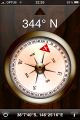
| + | Looking at my GPS, I was within 900m or the hash. An easy walking distance. Granted it was dark and wet, but under a Km is not that far is it? No!.... | ||
| + | |||
| + | (To Be Continued...) | ||
== Photos == | == Photos == | ||
Revision as of 13:00, 28 September 2009
| Fri 25 Sep 2009 in -38,146: -38.1235951, 146.4180346 geohashing.info google osm bing/os kml crox |
Contents
Location
Just off a "road" in Tyers State Park, north of Morwell.
Participants
Plans
I'm driving pretty much past on the way to Liconla, so I'll have a go. Google says there's a road almost to to the hashpoint.
Expedition
Short Version
google lied... ok... so technically there's a road, but it was made of mud and slopingness and overgrowingness.
decided to walk the last Km instead and got very wet and muddy and had no GPS reception in the trees and clouds and rain and dark.
Eventually gave up when i got to a 45 Degree slope covered in wet ferns, and it was obvious i would never get a good fix on the hash point.
Managed to walk Directly back to the car though... I wasn't lost (although it could have been managed pretty easily), just couldn't determine where I needed to go.
Camped in the Car at Licola over night, then had an annoying drive back to Melbourne the next day.
Long Version
I was going to drive to Licola today, and checked out the hashes on the way. It turned out that the Traralgon hash would be pretty close to the back-way from Moe to Heyfield, which is the main entry point for the road up to Licola. Google Maps shows a group of roads branching out near the hash, with one ending within a few hundred meters of the point itself. The hash itself is just on the North side of the hill, on a steepening slope.
The drive from Melbourne was uneventful, until I turned off the highway at Moe. The weather however was not so wonderful, and slowly deteriorating. I didn't think about it at the time, but the rain and low overcast would prove difficult later. I drove behind the cooling towers of the Yallourn Power Station, which made for an impressive sight with it's large concrete cooling tower, and white steam, against the dark overcast sky. Unfortunately my iPhone was incapable of taking a worthwhile photo.
I had a little trouble navigating towards Tylers State Park, mainly due to second-guessing myself (I did at one point end up at Lake Narracan, but it was only a few hundred meters or so in the wrong direction). Around this time I almost earned myself a Police ribbon. While driving along the edges of the towns, police lights lit up behind me. I didn't think I was doing anything illegal, and slowed down and pulled to the far left (as I should) to let the police past. However they stayed a hundred meters or so behind me. So I then pulled off the road completely, and stopped, expecting the police to pull up behind me. I was mightily confused when looking in the rear view mirror to see that they had apparently stopped, still a hundred meters or so behind me. It was only when I instead checked in a side mirror that I realised that they had pulled over a car behind me..... The police and the car they had stopped had been so perfectly aligned the whole time that I could not tell that there were in fact two cars.
Somewhat relieved, and feeling a little silly, I pulled out and kept going. I shortly found the turn off I would take up to the State Park, and headed up the road which I discovered was a wet dirt only by the feel of the driving (In the low light the dark and wet surface looked like a sealed road). After a minute or so of passing small farms, I was on Blair rd, with State park on one side, and approaching the intersection where I would enter the park proper (small as it may be).
Here I encountered what in hindsight was a warning sign. Blair rd was blocked by a gate preventing entry to the Park. But no matter! I wanted the open side road in any case. I took the 4wd track into the Park. I had only gone a hundred meters (to where the first branching intersection should be) when I encountered another warning sign. The left branch was blocked and overgrown, and the right had a foot high mound forming the lower side of a drainage ditch. however i was very close, and decided to persevere onwards. I was after all in a 4wd.
At the next and last intersection, the road became stupid. The left branch was a steep slope, 3 or 4 meters high, and up to a 60° grade until it topped an embankment... not an easy job at the best of times, and definitely not in the rain and with a muddy gloopy surface over a hard-packed clay-like under layer.The right branch (where i wanted to go) was better, with a much gentler slope, but the same road conditions. But wanting to get to the top of the hill before walking the last bit, I engaged 4wd and gave it a go. I got about 10 meters (half way) before deciding that I wasn't going to get up without spinning the wheels and destroying the track, so I stopped, and carefully backed down again. I parked back below the first branching of the track and took stock.
Looking at my GPS, I was within 900m or the hash. An easy walking distance. Granted it was dark and wet, but under a Km is not that far is it? No!....
(To Be Continued...)
Photos
Hashing
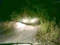
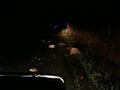
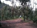
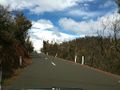
The road became interesting.
That road was stupid.
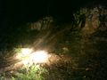
This road was less stupid, or would have been if it was dry.
Not the Hash.
Wet and muddy.


Licola and the journey Home
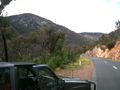
"Beware Falling Rocks".
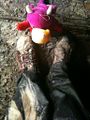
Sleepy cave.
Sleepy cave from the outside. (in the morning)
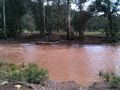
The Wellington River. Not for crossing today.
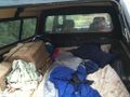
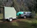
Not a bad spot to park.
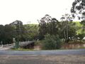
Licola
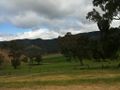
Paddocks and scenery.
Regrowth
Most of the way down the hill is like this.
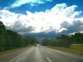
Ominous.
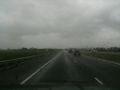
Yup... it was ominous.


