Difference between revisions of "2009-10-19 50 10"
From Geohashing
imported>Danatar (Report!) |
imported>FippeBot m (Location) |
||
| Line 31: | Line 31: | ||
[[Category:Coordinates reached]] | [[Category:Coordinates reached]] | ||
[[Category:Danatar]] | [[Category:Danatar]] | ||
| + | {{location|DE|BY|SW}} | ||
Latest revision as of 06:26, 8 August 2019
| Mon 19 Oct 2009 in Gotha: 50.0690916, 10.1075814 geohashing.info google osm bing/os kml crox |
Location
Today's location is in a harrowed field between Euerbach and Obbach, not far from Schweinfurt.
Country: Germany; state: Bayern (Bavaria, EU:DE:BY); administrative region: Unterfranken; district: Schweinfurt rural district
Expedition
Danatar
Another after-work-geohash. It was really easy to find: Start from work, turn right twice, then follow the road for a long while. It was dark when I parked the car on a field track next to the hashfield. I then walked the last metres along the road. The hashpoint was 10 metres inside the field but since I saw no plants I went there. After taking a picture I went back to the car and drove home.
I've been geohashing four days in a row.
Danatar earned the Consecutive geohash achievement
|

It's getting dark...
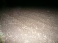
...and the ground is dirty...

...but the hashpoint is reached.


