Difference between revisions of "2009-10-25 33 -84"
(New page: {{meetup graticule | map=<map lat="33" lon="-84" date="2009-10-25" /> | lat=33 | lon=-84 | date=2009-10-25 | graticule_name=Atlanta | graticule_link=Atlanta, Georgia }} == Graticule == ...) |
imported>FippeBot m (Location) |
||
| (2 intermediate revisions by one other user not shown) | |||
| Line 32: | Line 32: | ||
== Gallery == | == Gallery == | ||
<gallery caption="Photo Gallery" widths="200px" heights="200px" perrow="3"> | <gallery caption="Photo Gallery" widths="200px" heights="200px" perrow="3"> | ||
| − | Image: | + | Image:2009102533-84NW01.JPG| The blocked off street of the undeveloped subdivision. |
| + | Image:2009102533-84NW02.JPG| The apartment complex that I parked at. | ||
| + | Image:2009102533-84NW03.JPG| The woods that I walked though. | ||
| + | Image:2009102533-84NW04.JPG| An entire air conditioner unit. Geotrash maybe? | ||
| + | Image:2009102533-84NW05.JPG| 385 feet to go from the back of the apartment complex. | ||
| + | Image:2009102533-84NW06.JPG| Anyone need a computer? | ||
| + | Image:2009102533-84NW07.JPG| 4.28 feet to go. Close enough. | ||
| + | Image:2009102533-84NW08.JPG| Time of the meetup. | ||
| + | Image:2009102533-84NW09.JPG| Date of the meetup. | ||
| + | Image:2009102533-84NW10.JPG| A picture of the actual spot of the geohash. | ||
| + | Image:2009102533-84NW11.JPG| It was real close to the railroad tracks. | ||
| + | Image:2009102533-84NW12.JPG| | ||
| + | Image:2009102533-84NW13.JPG| | ||
| + | Image:2009102533-84NW14.JPG| The artwork. | ||
| + | Image:2009102533-84NW15.JPG| Some pretty amazing. | ||
| + | Image:2009102533-84NW16.JPG| A good use of color. | ||
| + | Image:2009102533-84NW17.JPG| Lots of detail. | ||
| + | Image:2009102533-84NW18.JPG| Does anyone know why they are trying to keep frogs? | ||
| + | Image:2009102533-84NW19.JPG| I could have driven there. | ||
| + | Image:2009102533-84NW20.JPG| The railroad station. | ||
| + | Image:2009102533-84NW21.JPG| Nobody home. | ||
</gallery> | </gallery> | ||
| Line 38: | Line 58: | ||
{{land geohash | latitude = 33 | longitude = -84| date = 2009-10-25| name = NWoodruff}} | {{land geohash | latitude = 33 | longitude = -84| date = 2009-10-25| name = NWoodruff}} | ||
| + | {{consecutive geohash | count = 5 | latitude = 33 | longitude = -84 | date = 2009-10-21 | name = NWoodruff }} | ||
| + | |||
| Line 43: | Line 65: | ||
[[Category:Coordinates reached]] | [[Category:Coordinates reached]] | ||
[[Category:Expeditions with photos]] | [[Category:Expeditions with photos]] | ||
| + | {{location|US|GA|FU}} | ||
Latest revision as of 06:31, 8 August 2019
| Sun 25 Oct 2009 in Atlanta: 33.7392029, -84.5315647 geohashing.info google osm bing/os kml crox |
Graticule
About
Near some railroad track south of Adamsville Georgia, due West of Atlanta proper.
Expedition
LuxMundi
NWoodruff
I drove there following Google map directions. The last turn in to an undeveloped subdivision looked promising because there shouldn't be anyone's yard to trample through. Well, until I get to the road. The entire road had been chained off. I had Google maps with me and decided to drive to the next road. It was into an apartment complex which was just as fine as nobody living there was going to say anything about me walking through the woods.
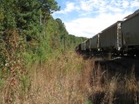
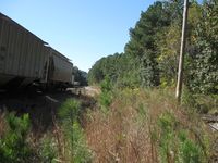
I hiked through the woods and came up on the railroad tracks. Some of the parked rail road cars had some cool graffiti. I found the hash point and took a few pictures. I then hiked back through the woods to my truck and drove out of the apartment complex.
Instead of driving back I decided to go one more street to see how much closer I could have got to the hash point. As it turned out I should have gone down one more street as I could have driven almost all the way to the hash spot.
I then turned around and drove back to Norcross.
Gallery
- Photo Gallery
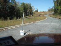
The blocked off street of the undeveloped subdivision.
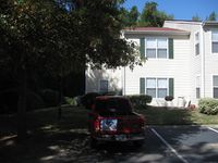
The apartment complex that I parked at.
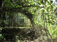
The woods that I walked though.

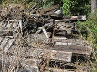
An entire air conditioner unit. Geotrash maybe?
385 feet to go from the back of the apartment complex.
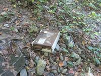
Anyone need a computer?
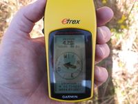
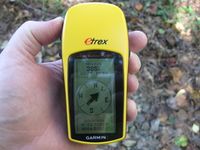
4.28 feet to go. Close enough.
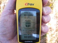
Time of the meetup.
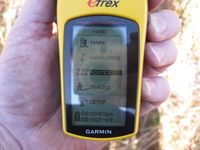
Date of the meetup.
A picture of the actual spot of the geohash.
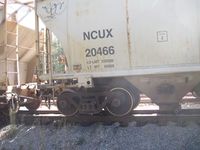
It was real close to the railroad tracks.
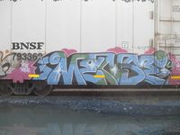
The artwork.
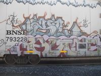
Some pretty amazing.
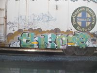
A good use of color.
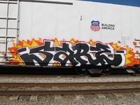
Lots of detail.
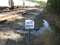
Does anyone know why they are trying to keep frogs?
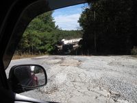
I could have driven there.
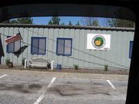
The railroad station.
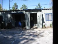
Nobody home.


Achievements
NWoodruff earned the Land geohash achievement
|
NWoodruff earned the Consecutive geohash achievement
|