Difference between revisions of "2009-10-29 52 -0"
From Geohashing
imported>Joehardflec (→Photos) |
imported>FippeBot m (Location) |
||
| (One intermediate revision by one other user not shown) | |||
| Line 23: | Line 23: | ||
<gallery perrow="3"> | <gallery perrow="3"> | ||
| − | Image:2009-10-29 52 -0 GPS.jpg | | + | Image:2009-10-29 52 -0 GPS.jpg | The co-ordinates to the best accuracy I could manage. |
| − | Image:2009-10-29 52 -0 Moon.jpg | | + | Image:2009-10-29 52 -0 Moon.jpg | The moon looked like a nice thing to take a photo of for some reason |
| − | Image:2009-10-29 52 -0 Field.jpg | | + | Image:2009-10-29 52 -0 Field.jpg | The view from the point |
| − | Image:2009-10-29 52 -0 Joe.jpg | | + | Image:2009-10-29 52 -0 Joe.jpg | Joe at the point. |
</gallery> | </gallery> | ||
| Line 33: | Line 33: | ||
[[Category:Expeditions with photos]] | [[Category:Expeditions with photos]] | ||
[[Category:Coordinates reached]] | [[Category:Coordinates reached]] | ||
| + | {{location|GB|ENG|LEC}} | ||
Latest revision as of 06:33, 8 August 2019
| Thu 29 Oct 2009 in 52,-0: 52.5080515, -0.8884250 geohashing.info google osm bing/os kml crox |
Location
In a field where a footpath joins up with the lane 'connecting' (I doubt the bridge in the middle is passable with any vehicle, but you can do it on foot) Great Bowden with Welham.
Participants
Expedition
Joe drove to Great Bowden, drove partway up the track, before walking to the right field and finding the point.
Photos
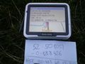
The co-ordinates to the best accuracy I could manage.
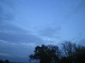
The moon looked like a nice thing to take a photo of for some reason
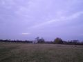
The view from the point

Joe at the point.


