| Wed 18 Nov 2009 in 35,-77: 35.2173464, -77.0606749 geohashing.info google osm bing/os kml crox |
Contents
Location
On a farm near Askin, North Carolina.
Participants
Expedition
Robyn was, as usual, geohashing as a diversion on her way to an airport. She was driving from Havelock, NC to Raleigh-Duram International Airport, and turned north off highway 70 onto highway 17 to try and capture the Greenville graticule. The directions were easy, right at the Askin and right again on an unnamed road. Unfortunately, a few hundred metres from the geohash a sign on a tree denied further access on account of porcine biohazards.
I tried again from a different approach, but that too was barred by private property. I did get to see a cotton field, though.
Photos
- Photos
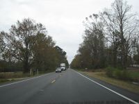
Driving to Askin was easy,
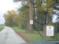
but I wasn't allowed closer because there were pigs on one side
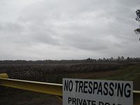
and cotton on the other.


